|
search place name
|
||
Douglassville (Texas, United States - USA)Douglassville is a town in the Texas region of United States - USA. An overview map of the region around Douglassville is displayed below.
regional and 3d topo map of Douglassville, United States - USA ::

Douglassville airports ::
The nearest airport is TXK - Texarkana Rgnl Webb Fld, located 44.5 km north east of Douglassville.
Other airports nearby include GGG - Longview East Texas Rgnl (95.7 km south), SHV - Shreveport Rgnl (96.3 km south east), BAD - Shreveport Barksdale Afb (100.2 km south east), TYR - Tyler Pounds Rgnl (135.3 km south west), Nearby towns ::
Panhandle (3.3km north) //
Gum Springs (4.8km south) //
Overcup Landing (5.2km north) //
Poorboy Landing (6.0km north east) //
Midway (6.3km south east) //
Red Hill (7.8km south) //
O'Farrell (8.1km south) //
Armstrong Landing (8.0km north east) //
[all distances 'as the bird flies' and approximate] 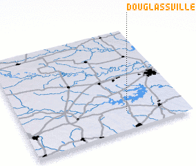 Places with similar names to Douglassville, United States - USA ::
// Douglasville (US)
// Douglasville (US)
// Douglasville (US)
// Declezville (US)
// Douglasville (US)
// Douglasville (US)
// Douglassville (US)
Disclaimer :: Information on this page comes without warranty of any kind |
||
|
Where is Douglassville? Elevation and coordinates ::
Latitude (lat): 33°11'31"N Longitude (lon): 94°21'12"W
Elevation (approx.): 123m (map arrows pan, magnifying glasses zoom) |
||
|
Visiting Douglassville? Hotel/Accommodation ::
Book a hotel in Douglassville Travel Guide ::
rental cars ::
car rental offers GPS waypoint ::
download a GPX waypoint (PoI) of Douglassville for your GPS receiver
|
||