|
search place name
|
||
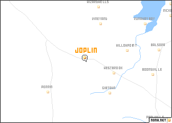
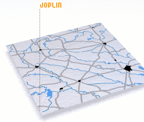
Joplin (Texas, United States - USA)Joplin is a town in the Texas region of United States - USA. An overview map of the region around Joplin is displayed below.
regional and 3d topo map of Joplin, United States - USA ::
Joplin airports ::
The nearest airport is FTW - Fort Worth Meacham Intl, located 66.4 km south east of Joplin.
Other airports nearby include DFW - Dallas-fort Worth Dallas Fort Worth Intl (92.0 km east), SPS - Sheppard Afb Wichita Falls Muni (109.5 km north west), DAL - Dallas Love Fld (110.3 km east), ABI - Abilene Rgnl (175.3 km south west), Nearby towns ::
 Places with similar names to Joplin, United States - USA ::
Disclaimer :: Information on this page comes without warranty of any kind |
||
|
Where is Joplin? Elevation and coordinates ::
Latitude (lat): 33°5'37"N Longitude (lon): 97°59'40"W
Elevation (approx.): 354m (map arrows pan, magnifying glasses zoom) |
||
|
Visiting Joplin? Hotel/Accommodation ::
Book a hotel in Joplin Travel Guide ::
rental cars ::
car rental offers GPS waypoint ::
download a GPX waypoint (PoI) of Joplin for your GPS receiver
|
||