|
search place name
|
||
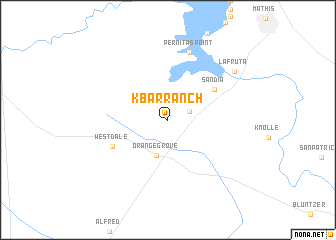
K-Bar Ranch (Texas, United States - USA)K-Bar Ranch is a town in the Texas region of United States - USA. An overview map of the region around K-Bar Ranch is displayed below.
regional and 3d topo map of K-Bar Ranch, United States - USA ::
K-Bar Ranch airports ::
The nearest airport is ALI - Alice Intl, located 29.6 km south of K-Bar Ranch.
Other airports nearby include CRP - Corpus Christi Intl (48.5 km south east), NQI - Kingsville Nas (54.9 km south), LRD - Laredo Intl (159.3 km west), SKF - San Antonio Lackland Afb Kelly Fld Annex (167.1 km north), Nearby towns ::
Casa Blanca (2.4km north east) //
Orange Grove (4.1km south) //
Sandia (5.7km north east) //
Westdale (6.2km south west) //
Pernitas Point (7.8km north) //
La Fruta (8.5km north east) //
[all distances 'as the bird flies' and approximate] 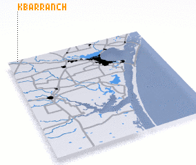 Places with similar names to K-Bar Ranch, United States - USA :: Disclaimer :: Information on this page comes without warranty of any kind |
||
|
Where is K-Bar Ranch? Elevation and coordinates ::
Latitude (lat): 27°59'31"N Longitude (lon): 97°55'32"W
Elevation (approx.): 60m (map arrows pan, magnifying glasses zoom) |
||
|
Visiting K-Bar Ranch? Hotel/Accommodation ::
Book a hotel in K-Bar Ranch Travel Guide ::
rental cars ::
car rental offers GPS waypoint ::
download a GPX waypoint (PoI) of K-Bar Ranch for your GPS receiver
|
||