|
search place name
|
||
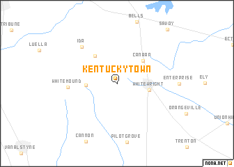
Kentucky Town (Texas, United States - USA)Kentucky Town is a town in the Texas region of United States - USA. An overview map of the region around Kentucky Town is displayed below.
regional and 3d topo map of Kentucky Town, United States - USA ::
Kentucky Town airports ::
The nearest airport is DAL - Dallas Love Fld, located 84.2 km south west of Kentucky Town.
Other airports nearby include DFW - Dallas-fort Worth Dallas Fort Worth Intl (89.0 km south west), FTW - Fort Worth Meacham Intl (116.1 km south west), TYR - Tyler Pounds Rgnl (161.7 km south east), MLC - Mcalester Mc Alester Rgnl (162.6 km north), Nearby towns ::
Tom Bean (4.2km west) //
Whitewright (4.4km east) //
Canaan (5.0km north east) //
Whiterock (5.4km north west) //
White Mound (6.6km west) //
Ida (7.6km north west) //
Savoy (10.9km north east) //
[all distances 'as the bird flies' and approximate]  Places with similar names to Kentucky Town, United States - USA ::
// Guindaguitan (PH)
// Cañada Catena (ES)
// Kendigtown (US)
// Kānādukāttān (IN)
// Kundi Kotāna (PK)
// Quinatacutan (PH)
// Cañada Cadena (DO)
Disclaimer :: Information on this page comes without warranty of any kind |
||
|
Where is Kentucky Town? Elevation and coordinates ::
Latitude (lat): 33°31'18"N Longitude (lon): 96°26'19"W
Elevation (approx.): 255m (map arrows pan, magnifying glasses zoom) |
||
|
Visiting Kentucky Town? Hotel/Accommodation ::
Book a hotel in Kentucky Town Travel Guide ::
rental cars ::
car rental offers GPS waypoint ::
download a GPX waypoint (PoI) of Kentucky Town for your GPS receiver
|
||