|
search place name
|
||
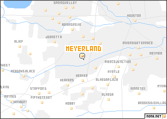
Meyerland (Texas, United States - USA)Meyerland is a town in the Texas region of United States - USA. An overview map of the region around Meyerland is displayed below.
regional and 3d topo map of Meyerland, United States - USA ::
Meyerland airports ::
The nearest airport is HOU - Houston William P Hobby, located 18.7 km east of Meyerland.
Other airports nearby include IAH - George Bush Intcntl Houston (35.4 km north), CXO - Conroe Lone Star Executive (74.1 km north), GLS - Scholes Intl At Galveston (75.0 km south east), CLL - College Station Easterwood Fld (132.3 km north west), Nearby towns ::
Bellaire (2.5km north) //
Westwood Park (3.0km south east) //
Southside Place (3.8km north east) //
South Side Place (4.2km north east) //
Heaker (4.7km south) //
Bellaire Junction (5.1km north) //
Lamar Terrace (5.2km north) //
West University Place (4.9km north east) //
Heakers (6.5km south west) //
Pamela Heights (6.7km south) //
Briargrove (7.1km north) //
Jeanetta (6.9km north west) //
Winchester (7.8km south) //
Almeda Plaza (7.3km south east) //
Myrtle (7.2km south east) //
Pierce Junction (7.1km east) //
Piney Point Village (9.6km north west) //
Missouri City (10.0km south west) //
[all distances 'as the bird flies' and approximate]  Places with similar names to Meyerland, United States - USA :: Disclaimer :: Information on this page comes without warranty of any kind |
||
|
Where is Meyerland? Elevation and coordinates ::
Latitude (lat): 29°41'5"N Longitude (lon): 95°28'2"W
Elevation (approx.): 21m (map arrows pan, magnifying glasses zoom) |
||
|
Visiting Meyerland? Hotel/Accommodation ::
Book a hotel in Meyerland Travel Guide ::
rental cars ::
car rental offers GPS waypoint ::
download a GPX waypoint (PoI) of Meyerland for your GPS receiver
|
||