|
search place name
|
||
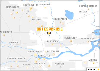
Oates Prairie (Texas, United States - USA)Oates Prairie is a town in the Texas region of United States - USA. An overview map of the region around Oates Prairie is displayed below.
regional and 3d topo map of Oates Prairie, United States - USA ::
Oates Prairie airports ::
The nearest airport is HOU - Houston William P Hobby, located 17.1 km south of Oates Prairie.
Other airports nearby include IAH - George Bush Intcntl Houston (22.9 km north west), CXO - Conroe Lone Star Executive (63.7 km north), GLS - Scholes Intl At Galveston (69.6 km south east), BPT - Beaumont Southeast Texas Rgnl (119.2 km east), Nearby towns ::
Jacinto City (3.4km south) //
East Houston (4.5km north west) //
Greens Bayou (4.9km south east) //
Houmont Park (6.1km north east) //
Clinton Park (6.4km south) //
Beaumont Place (6.1km north east) //
Settegast (6.4km north west) //
Galena Park (7.1km south) //
Cloverleaf (7.1km east) //
Manchester (8.9km south) //
Magnolia Park (8.6km south west) //
North Shadydale (8.5km north west) //
Scenic Woods (9.1km north west) //
Harrisburg (9.5km south) //
Calgary Woods (10.2km north west) //
Sherwood Place (11.4km north west) //
[all distances 'as the bird flies' and approximate] 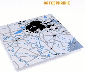 Places with similar names to Oates Prairie, United States - USA :: Disclaimer :: Information on this page comes without warranty of any kind |
||
|
Where is Oates Prairie? Elevation and coordinates ::
Latitude (lat): 29°47'48"N Longitude (lon): 95°14'32"W
Elevation (approx.): 14m (map arrows pan, magnifying glasses zoom) |
||
|
Visiting Oates Prairie? Hotel/Accommodation ::
Book a hotel in Oates Prairie Travel Guide ::
rental cars ::
car rental offers GPS waypoint ::
download a GPX waypoint (PoI) of Oates Prairie for your GPS receiver
|
||