|
search place name
|
||
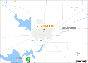
San Angelo (Texas, United States - USA)San Angelo is a town in the Texas region of United States - USA. An overview map of the region around San Angelo is displayed below.
regional and 3d topo map of San Angelo, United States - USA ::
San Angelo airports ::
The nearest airport is SJT - San Angelo Rgnl Mathis Fld, located 13.0 km south west of San Angelo.
Other airports nearby include DYS - Abilene Dyess Afb (119.6 km north east), ABI - Abilene Rgnl (127.0 km north east), MAF - Midland Intl (175.6 km west), SAT - San Antonio Intl (285.3 km south east), Nearby towns ::
Alvery Junction (2.7km north east) //
S N Junction (5.3km south west) //
[all distances 'as the bird flies' and approximate] 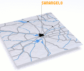 Places with similar names to San Angelo, United States - USA ::
Disclaimer :: Information on this page comes without warranty of any kind |
||
|
Where is San Angelo? Elevation and coordinates ::
Latitude (lat): 31°27'49"N Longitude (lon): 100°26'12"W
Elevation (approx.): 564m (map arrows pan, magnifying glasses zoom) |
||
|
Visiting San Angelo? Hotel/Accommodation ::
Book a hotel in San Angelo Travel Guide ::
rental cars ::
car rental offers GPS waypoint ::
download a GPX waypoint (PoI) of San Angelo for your GPS receiver
|
||