|
search place name
|
||
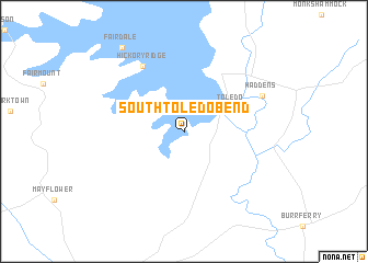
South Toledo Bend (Texas, United States - USA)South Toledo Bend is a town in the Texas region of United States - USA. An overview map of the region around South Toledo Bend is displayed below.
regional and 3d topo map of South Toledo Bend, United States - USA ::
South Toledo Bend airports ::
The nearest airport is POE - Fort Polk Polk Aaf, located 41.2 km east of South Toledo Bend.
Other airports nearby include DRI - Deridder Beauregard Rgnl (43.7 km south east), AEX - Alexandria Intl (102.3 km east), LCH - Lake Charles Rgnl (119.6 km south), ESF - Alexandria Esler Rgnl (127.5 km east), Nearby towns ::
Toledo (4.7km north east) //
Hickory Ridge (7.5km north west) //
Haddens (7.7km north east) //
Fairdale (10.2km north west) //
[all distances 'as the bird flies' and approximate] 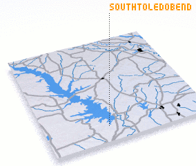 Places with similar names to South Toledo Bend, United States - USA :: Disclaimer :: Information on this page comes without warranty of any kind |
||
|
Where is South Toledo Bend? Elevation and coordinates ::
Latitude (lat): 31°9'11"N Longitude (lon): 93°36'16"W
Elevation (approx.): 61m (map arrows pan, magnifying glasses zoom) |
||
|
Visiting South Toledo Bend? Hotel/Accommodation ::
Book a hotel in South Toledo Bend Travel Guide ::
rental cars ::
car rental offers GPS waypoint ::
download a GPX waypoint (PoI) of South Toledo Bend for your GPS receiver
|
||