|
search place name
|
||
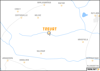
Trevat (Texas, United States - USA)Trevat is a town in the Texas region of United States - USA. An overview map of the region around Trevat is displayed below.
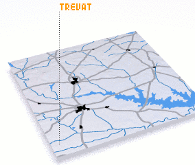
regional and 3d topo map of Trevat, United States - USA ::
Trevat airports ::
The nearest airport is CXO - Conroe Lone Star Executive, located 96.2 km south west of Trevat.
Other airports nearby include IAH - George Bush Intcntl Houston (131.5 km south), GGG - Longview East Texas Rgnl (141.9 km north), TYR - Tyler Pounds Rgnl (143.5 km north), CLL - College Station Easterwood Fld (147.8 km south west), Nearby towns ::
 Places with similar names to Trevat, United States - USA ::
// Douar Fâata (MA)
// Drift (DE)
// Drift (DE)
// Trift (DE)
// Terra Feita (PT)
// Terrafeita (PT)
// Turifit (NO)
// Tarvydai (LT)
// Tarvydai (LT)
// Tarvydai (LT)
Disclaimer :: Information on this page comes without warranty of any kind |
||
|
Where is Trevat? Elevation and coordinates ::
Latitude (lat): 31°7'11"N Longitude (lon): 94°56'46"W
Elevation (approx.): 70m (map arrows pan, magnifying glasses zoom) |
||
|
Visiting Trevat? Hotel/Accommodation ::
Book a hotel in Trevat Travel Guide ::
rental cars ::
car rental offers GPS waypoint ::
download a GPX waypoint (PoI) of Trevat for your GPS receiver
|
||