|
search place name
|
||
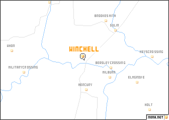
Winchell (Texas, United States - USA)Winchell is a town in the Texas region of United States - USA. An overview map of the region around Winchell is displayed below.
regional and 3d topo map of Winchell, United States - USA ::
Winchell airports ::
The nearest airport is ABI - Abilene Rgnl, located 115.2 km north west of Winchell.
Other airports nearby include DYS - Abilene Dyess Afb (124.0 km north west), SJT - San Angelo Rgnl Mathis Fld (127.6 km west), GRK - Killeen Robert Gray Aaf (134.5 km east), HLR - Fort Hood Hood Aaf (142.5 km east), Nearby towns ::
Beasley Crossing (5.3km east) //
Mercury (6.6km south) //
Milburn (6.2km south east) //
Dulin (8.9km north east) //
Brookesmith (9.6km north east) //
[all distances 'as the bird flies' and approximate] 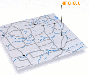 Places with similar names to Winchell, United States - USA ::
// Winchell (US)
// Wun Shol (SD)
// Wŏnch'ŏl-li (KR)
// Wŏnch'ŏl-li (KR)
// Wŏnch'ŏl-li (KR)
// Wŏnch'ŏl-li (KR)
// Wŏnch'ol-li (KR)
// Wŏnch'ol-li (KR)
// Wŏnch'ol-li (KR)
// Wŏnch'ol-li (KP)
Disclaimer :: Information on this page comes without warranty of any kind |
||
|
Where is Winchell? Elevation and coordinates ::
Latitude (lat): 31°28'19"N Longitude (lon): 99°9'38"W
Elevation (approx.): 412m (map arrows pan, magnifying glasses zoom) |
||
|
Visiting Winchell? Hotel/Accommodation ::
Book a hotel in Winchell Travel Guide ::
rental cars ::
car rental offers GPS waypoint ::
download a GPX waypoint (PoI) of Winchell for your GPS receiver
|
||