|
search place name
|
||
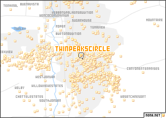
Twin Peaks Circle (Utah, United States - USA)Twin Peaks Circle is a town in the Utah region of United States - USA. An overview map of the region around Twin Peaks Circle is displayed below.
regional and 3d topo map of Twin Peaks Circle, United States - USA ::
Twin Peaks Circle airports ::
The nearest airport is SLC - Salt Lake City Intl, located 17.8 km north west of Twin Peaks Circle.
Other airports nearby include HIF - Ogden Hill Afb (52.9 km north), Nearby towns ::
Paradise Park (0.2km north) //
Mountain View Orchard Heights (0.4km north) //
Mount Olympus Gardens Condominium (0.3km west) //
Dover Hill Condominium (0.4km north) //
Valley Fair Estates (0.5km south) //
Huff Acres (0.6km north) //
Chevy Chase (0.5km south east) //
Birch Point Condominium (0.5km east) //
Howe (0.7km south) //
Executive Suites of Fountain East (0.7km north) //
Fairway Estates Condominium (0.7km west) //
South Cottonwood Acres (0.9km south) //
Huffaker (1.0km north) //
Three Fountains Townhomes and Manor Houses (0.9km north west) //
Prowswood Plaza Condominium (1.0km north) //
Birchwood Estates (1.0km south) //
Three Fountains Young American Family Condominium (1.0km north west) //
Spring Hill Condominium (0.9km west) //
Lake Pines Apartment Condominium (1.1km north) //
Rivendell Condominium (1.1km south) //
Tyler (0.9km south east) //
Angie Circle Condominium (0.9km west) //
Hyland Lake (1.2km south) //
Edinburgh of Holladay Condominium (1.3km north) //
Fischner Phillips Condominium (1.1km north west) //
Creekside East Condominium (1.0km west) //
Brookwood Condominiums (1.3km north east) //
Three Fountains Manor House Condominium (1.2km north west) //
Pheasant Hollow (1.2km north east) //
[all distances 'as the bird flies' and approximate] 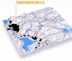 Places with similar names to Twin Peaks Circle, United States - USA :: Disclaimer :: Information on this page comes without warranty of any kind |
||
|
Where is Twin Peaks Circle? Elevation and coordinates ::
Latitude (lat): 40°39'17"N Longitude (lon): 111°51'43"W
Elevation (approx.): 1330m (map arrows pan, magnifying glasses zoom) |
||
|
Visiting Twin Peaks Circle? Hotel/Accommodation ::
Book a hotel in Twin Peaks Circle Travel Guide ::
rental cars ::
car rental offers GPS waypoint ::
download a GPX waypoint (PoI) of Twin Peaks Circle for your GPS receiver
|
||