|
search place name
|
||
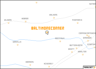
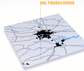
Baltimore Corner (Virginia, United States - USA)Baltimore Corner is a town in the Virginia region of United States - USA. An overview map of the region around Baltimore Corner is displayed below.
regional and 3d topo map of Baltimore Corner, United States - USA ::
Baltimore Corner airports ::
The nearest airport is RIC - Richmond Intl, located 57.8 km north east of Baltimore Corner.
Other airports nearby include PHF - Newport News Williamsburg Intl (109.8 km east), LFI - Hampton Langley Afb (121.5 km east), NGU - Norfolk Ns (129.2 km east), ORF - Norfolk Intl (137.7 km east), Nearby towns ::
 Places with similar names to Baltimore Corner, United States - USA ::
// Baltimore Corner (US)
Disclaimer :: Information on this page comes without warranty of any kind |
||
|
Where is Baltimore Corner? Elevation and coordinates ::
Latitude (lat): 37°5'56"N Longitude (lon): 77°43'38"W
Elevation (approx.): 95m (map arrows pan, magnifying glasses zoom) |
||
|
Visiting Baltimore Corner? Hotel/Accommodation ::
Book a hotel in Baltimore Corner Travel Guide ::
rental cars ::
car rental offers GPS waypoint ::
download a GPX waypoint (PoI) of Baltimore Corner for your GPS receiver
|
||