|
search place name
|
||
Boudar (Virginia, United States - USA)Boudar is a town in the Virginia region of United States - USA. An overview map of the region around Boudar is displayed below.
regional and 3d topo map of Boudar, United States - USA ::

Boudar airports ::
The nearest airport is RIC - Richmond Intl, located 20.8 km south east of Boudar.
Other airports nearby include PHF - Newport News Williamsburg Intl (104.7 km south east), LFI - Hampton Langley Afb (117.6 km south east), NHK - Patuxent River Nas (120.3 km north east), NGU - Norfolk Ns (131.8 km south east), Nearby towns ::
Greendale (1.5km south) //
Laurel Park (1.8km north) //
Lydell Heights (1.6km north east) //
West Jenningsville (1.8km north west) //
Laurel (2.0km north west) //
Woodman Terrace (2.3km north) //
Laurel Village (2.3km north west) //
Northwoods (2.3km north east) //
Dumbarton (2.7km south) //
Laurel Lakes (2.8km north west) //
Lakeside (2.9km south east) //
Stonewall Manor (2.8km east) //
North Run Estates (3.2km north east) //
Randolph Ridge (3.3km north east) //
Sweet Briar Park (3.0km west) //
Middleton (3.3km north east) //
Bretton Woods (3.8km north) //
Saint Josephs Villa (3.3km east) //
Biltmore (3.7km north east) //
Crestview (3.8km south west) //
Mountain Laurel (4.2km north) //
Glen Allen (4.4km north) //
Yellow Tavern (3.6km east) //
Solomons Store (3.7km east) //
Laurel West (4.6km north) //
Longdale (4.3km north east) //
Westhampton (4.7km south) //
Greenwood (4.8km north east) //
Quail Walk (5.3km north) //
[all distances 'as the bird flies' and approximate] 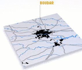 Places with similar names to Boudar, United States - USA ::
Disclaimer :: Information on this page comes without warranty of any kind |
||
|
Where is Boudar? Elevation and coordinates ::
Latitude (lat): 37°37'37"N Longitude (lon): 77°29'57"W
Elevation (approx.): 61m (map arrows pan, magnifying glasses zoom) |
||
|
Visiting Boudar? Hotel/Accommodation ::
Book a hotel in Boudar Travel Guide ::
rental cars ::
car rental offers GPS waypoint ::
download a GPX waypoint (PoI) of Boudar for your GPS receiver
|
||