|
search place name
|
||
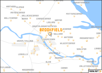
Brookfield (Virginia, United States - USA)Brookfield is a town in the Virginia region of United States - USA. An overview map of the region around Brookfield is displayed below.
regional and 3d topo map of Brookfield, United States - USA ::
Brookfield airports ::
The nearest airport is DCA - Ronald Reagan Washington Natl, located 69.2 km north east of Brookfield.
Other airports nearby include IAD - Washington Dulles Intl (70.3 km north), ADW - Camp Springs Andrews Afb (Washington Dc Naf) (74.2 km north east), NHK - Patuxent River Nas (89.4 km east), RIC - Richmond Intl (90.0 km south), Nearby towns ::
Grafton Village (1.6km north west) //
Dahlgren Junction (1.4km west) //
Chatham Heights (1.6km west) //
Ferry Farm (2.0km south) //
Highland Homes (2.2km north) //
Sullivan (2.0km east) //
Argyle Heights (2.7km south) //
Bel Air (2.7km north) //
Fredericksburg (2.6km west) //
Hazel Hill (2.7km south west) //
Tylerton (3.3km south) //
Mount Pleasant Estates (3.4km north west) //
Spring Valley (3.3km north west) //
Mayfield (3.5km south west) //
McCarthys Corner (3.1km east) //
Falmouth (3.4km north west) //
Leeland (4.3km north) //
Sylvania Heights (4.3km south) //
Little Falls (4.4km south) //
Stones Corner (4.1km north east) //
Maryes Heights (4.1km west) //
Mansfield Hall (5.2km south) //
Daffan (5.5km north east) //
Braehead Woods (5.3km south west) //
Cranes Corner (6.0km north) //
White Oak (5.2km east) //
Confederate Ridge (5.9km south west) //
Wildcat Corner (5.9km south east) //
Greenfield (7.1km south) //
[all distances 'as the bird flies' and approximate] 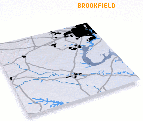 Places with similar names to Brookfield, United States - USA ::
Disclaimer :: Information on this page comes without warranty of any kind |
||
|
Where is Brookfield? Elevation and coordinates ::
Latitude (lat): 38°18'40"N Longitude (lon): 77°25'59"W
Elevation (approx.): 55m (map arrows pan, magnifying glasses zoom) |
||
|
Visiting Brookfield? Hotel/Accommodation ::
Book a hotel in Brookfield Travel Guide ::
rental cars ::
car rental offers GPS waypoint ::
download a GPX waypoint (PoI) of Brookfield for your GPS receiver
|
||