|
search place name
|
||
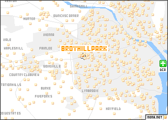
Broyhill Park (Virginia, United States - USA)Broyhill Park is a town in the Virginia region of United States - USA. An overview map of the region around Broyhill Park is displayed below.
regional and 3d topo map of Broyhill Park, United States - USA ::
Broyhill Park airports ::
The nearest airport is DCA - Ronald Reagan Washington Natl, located 13.8 km east of Broyhill Park.
Other airports nearby include IAD - Washington Dulles Intl (24.4 km north west), ADW - Camp Springs Andrews Afb (Washington Dc Naf) (29.1 km east), BWI - Baltimore Washington Intl (57.6 km north east), NHK - Patuxent River Nas (93.5 km south east), Nearby towns ::
Woodley (0.5km north east) //
Jefferson (0.9km north east) //
Woodley North (1.1km north east) //
Fenwick Park (1.1km north west) //
Pine Spring (1.1km north west) //
Tyler Park (1.4km north) //
Broyhill Crest (1.5km south) //
Tremont Gardens (1.5km north) //
Devonshire Gardens (1.4km north east) //
Holmes Run Acres (1.3km south west) //
Valley Brook (1.5km south east) //
Masonville (1.6km south) //
Annalee Heights (1.4km east) //
Westlawn (1.5km north east) //
Holmes Run Heights (1.9km south west) //
Bel Air (1.7km east) //
Jefferson Village (1.9km north east) //
Pleasant Ridge (2.1km south west) //
Greenway Downs (2.2km north east) //
Columbia Pines (2.3km south) //
Kenwood (2.4km south) //
Brockmont (2.2km north east) //
Donna Lee Gardens (2.4km north) //
Virginia Forest (2.7km north) //
Westwood Park (2.7km north) //
Holmes Run Park (2.3km south east) //
Sleepy Hollow Woods (2.5km south east) //
Poplar Heights (3.0km north) //
Marlo Heights (2.4km east) //
[all distances 'as the bird flies' and approximate] 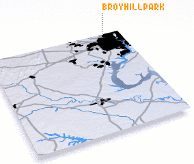 Places with similar names to Broyhill Park, United States - USA :: Disclaimer :: Information on this page comes without warranty of any kind |
||
|
Where is Broyhill Park? Elevation and coordinates ::
Latitude (lat): 38°51'36"N Longitude (lon): 77°11'48"W
Elevation (approx.): 96m (map arrows pan, magnifying glasses zoom) |
||
|
Visiting Broyhill Park? Hotel/Accommodation ::
Book a hotel in Broyhill Park Travel Guide ::
rental cars ::
car rental offers GPS waypoint ::
download a GPX waypoint (PoI) of Broyhill Park for your GPS receiver
|
||