|
search place name
|
||
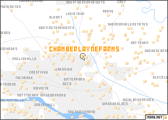
Chamberlayne Farms (Virginia, United States - USA)Chamberlayne Farms is a town in the Virginia region of United States - USA. An overview map of the region around Chamberlayne Farms is displayed below.
regional and 3d topo map of Chamberlayne Farms, United States - USA ::
Chamberlayne Farms airports ::
The nearest airport is RIC - Richmond Intl, located 17.6 km south east of Chamberlayne Farms.
Other airports nearby include PHF - Newport News Williamsburg Intl (100.5 km south east), LFI - Hampton Langley Afb (113.3 km south east), NHK - Patuxent River Nas (115.7 km north east), NGU - Norfolk Ns (127.8 km south east), Nearby towns ::
Northfield (0.8km north east) //
Chamberlayne Heights (0.8km south east) //
Schrader Woods (0.8km east) //
Chamberlayne (1.1km south east) //
Yellow Tavern (1.9km west) //
Solomons Store (2.1km west) //
Saint Josephs Villa (2.1km west) //
Brook Hill (3.1km south) //
Craney Island Estates (2.9km north east) //
Middleton (2.8km north west) //
Stonewall Manor (2.8km west) //
Chickahominy (3.5km south east) //
Stapleton (3.8km north east) //
Biltmore (3.4km north west) //
Atlee Manor (3.7km north east) //
Atlee (3.8km north east) //
Atlee Station (3.7km north east) //
Fayette Park (4.3km south) //
North Run Estates (3.7km north west) //
Longdale (4.0km north west) //
Cloverland (4.6km south) //
Northwoods (3.7km west) //
Greenwood (4.2km north west) //
Holly Glen Estates (4.5km north west) //
Ellerson (3.9km south east) //
Beechwood Farms (4.8km north) //
Hanover Heights (4.0km north east) //
Hanover Heights South (4.0km north east) //
Randolph Ridge (4.1km north west) //
[all distances 'as the bird flies' and approximate] 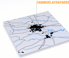 Places with similar names to Chamberlayne Farms, United States - USA :: Disclaimer :: Information on this page comes without warranty of any kind |
||
|
Where is Chamberlayne Farms? Elevation and coordinates ::
Latitude (lat): 37°37'59"N Longitude (lon): 77°26'16"W
Elevation (approx.): 58m (map arrows pan, magnifying glasses zoom) |
||
|
Visiting Chamberlayne Farms? Hotel/Accommodation ::
Book a hotel in Chamberlayne Farms Travel Guide ::
rental cars ::
car rental offers GPS waypoint ::
download a GPX waypoint (PoI) of Chamberlayne Farms for your GPS receiver
|
||