|
search place name
|
||
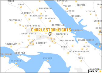
Charleston Heights (Virginia, United States - USA)Charleston Heights is a town in the Virginia region of United States - USA. An overview map of the region around Charleston Heights is displayed below.
regional and 3d topo map of Charleston Heights, United States - USA ::
Charleston Heights airports ::
The nearest airport is PHF - Newport News Williamsburg Intl, located 22.1 km south east of Charleston Heights.
Other airports nearby include LFI - Hampton Langley Afb (34.6 km south east), NGU - Norfolk Ns (50.2 km south east), ORF - Norfolk Intl (59.1 km south east), RIC - Richmond Intl (63.0 km north west), Nearby towns ::
Nelson Park (0.5km south) //
James Terrace (1.0km south) //
Parkway Estates (1.1km north) //
Middletowne Farms (1.0km south west) //
York Terrace (1.2km south east) //
Colonial Park (1.7km south) //
Forest Hill Park (1.9km north west) //
Queens Lake (2.4km north east) //
Carver Gardens (2.5km south east) //
Kingsmill On The James (3.4km south) //
Springfield (3.2km east) //
Williamsburg (3.2km west) //
Porta Bello (3.9km north east) //
Kingspoint (4.4km south west) //
Plantation Heights (4.3km north west) //
Greensprings (4.3km north west) //
Magruder (5.8km north) //
Charles Corner (5.1km south east) //
Walnut Hills (5.2km west) //
Grove (6.0km south east) //
Berkeley Hills (5.4km west) //
Rich Neck Heights (5.6km west) //
Birchwood Park (6.0km south west) //
Skipwith Farms (6.1km north west) //
Winston Terrace (6.2km west) //
Oaktree (7.5km north west) //
Canterbury Hills (6.5km west) //
Kingswood (6.6km west) //
Schenck Estates (7.7km north west) //
[all distances 'as the bird flies' and approximate] 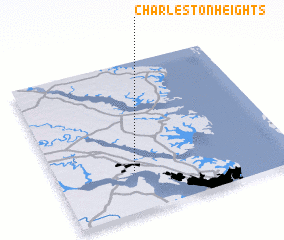 Places with similar names to Charleston Heights, United States - USA ::
// Charleston Heights (US)
Disclaimer :: Information on this page comes without warranty of any kind |
||
|
Where is Charleston Heights? Elevation and coordinates ::
Latitude (lat): 37°16'16"N Longitude (lon): 76°40'16"W
Elevation (approx.): 28m (map arrows pan, magnifying glasses zoom) |
||
|
Visiting Charleston Heights? Hotel/Accommodation ::
Book a hotel in Charleston Heights Travel Guide ::
rental cars ::
car rental offers GPS waypoint ::
download a GPX waypoint (PoI) of Charleston Heights for your GPS receiver
|
||