|
search place name
|
||
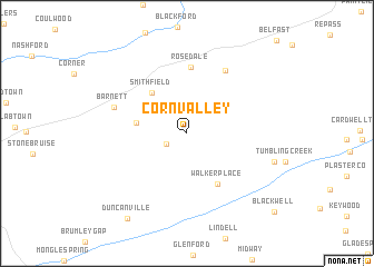
Corn Valley (Virginia, United States - USA)Corn Valley is a town in the Virginia region of United States - USA. An overview map of the region around Corn Valley is displayed below.
regional and 3d topo map of Corn Valley, United States - USA ::
Corn Valley airports ::
The nearest airport is HKY - Hickory Rgnl, located 137.6 km south of Corn Valley.
Other airports nearby include INT - Winston-salem Smith Reynolds (175.4 km south east), CLT - Charlotte Douglas Intl (207.3 km south east), Nearby towns ::
Rockdell (2.0km south west) //
Elk Garden (4.2km west) //
Smithfield (5.0km north west) //
Walker Place (5.7km south east) //
Rosedale (6.6km north) //
Jacksons Store (7.1km north east) //
Barnett (6.5km north west) //
Henderson (7.5km east) //
Duncanville (9.7km south west) //
Blackwell (10.5km south east) //
[all distances 'as the bird flies' and approximate] 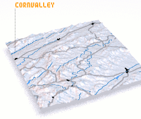 Places with similar names to Corn Valley, United States - USA ::
// Greenville (US)
// Cornville (US)
// Granville (US)
// Green Valley (US)
// Greenville (US)
// Green Valley (US)
// Green Valley (US)
// Greenville (US)
// Greenville (US)
// Guerneville (US)
Disclaimer :: Information on this page comes without warranty of any kind |
||
|
Where is Corn Valley? Elevation and coordinates ::
Latitude (lat): 36°53'59"N Longitude (lon): 81°56'6"W
Elevation (approx.): 713m (map arrows pan, magnifying glasses zoom) |
||
|
Visiting Corn Valley? Hotel/Accommodation ::
Book a hotel in Corn Valley Travel Guide ::
rental cars ::
car rental offers GPS waypoint ::
download a GPX waypoint (PoI) of Corn Valley for your GPS receiver
|
||