|
search place name
|
||
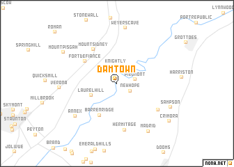
Damtown (Virginia, United States - USA)Damtown is a town in the Virginia region of United States - USA. An overview map of the region around Damtown is displayed below.
regional and 3d topo map of Damtown, United States - USA ::
Damtown airports ::
The nearest airport is EKN - Elkins Randolph Co Jennings Randolph, located 111.0 km north west of Damtown.
Other airports nearby include IAD - Washington Dulles Intl (151.9 km north east), RIC - Richmond Intl (161.4 km south east), DCA - Ronald Reagan Washington Natl (179.4 km north east), Nearby towns ::
New Hope (2.1km south east) //
Knightly (2.8km north) //
Piedmont (2.4km east) //
Laurel Hill (3.7km south west) //
Barren Ridge (5.5km south west) //
Fort Defiance (5.4km north west) //
Mount Sidney (6.2km north west) //
Hermitage (7.5km south) //
Red Mills (6.7km south east) //
Annex (7.4km south west) //
Weyers Cave (9.0km north) //
Madrid (8.6km south east) //
Sampson (7.8km south east) //
Mount Pisgah (8.4km north west) //
Crimora (8.9km south east) //
[all distances 'as the bird flies' and approximate] 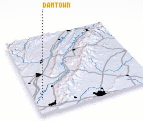 Places with similar names to Damtown, United States - USA ::
Disclaimer :: Information on this page comes without warranty of any kind |
||
|
Where is Damtown? Elevation and coordinates ::
Latitude (lat): 38°12'30"N Longitude (lon): 78°55'32"W
Elevation (approx.): 344m (map arrows pan, magnifying glasses zoom) |
||
|
Visiting Damtown? Hotel/Accommodation ::
Book a hotel in Damtown Travel Guide ::
rental cars ::
car rental offers GPS waypoint ::
download a GPX waypoint (PoI) of Damtown for your GPS receiver
|
||