|
search place name
|
||
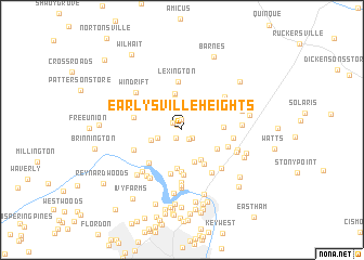
Earlysville Heights (Virginia, United States - USA)Earlysville Heights is a town in the Virginia region of United States - USA. An overview map of the region around Earlysville Heights is displayed below.
regional and 3d topo map of Earlysville Heights, United States - USA ::
Earlysville Heights airports ::
The nearest airport is RIC - Richmond Intl, located 124.8 km south east of Earlysville Heights.
Other airports nearby include IAD - Washington Dulles Intl (125.2 km north east), EKN - Elkins Randolph Co Jennings Randolph (145.4 km north west), DCA - Ronald Reagan Washington Natl (147.7 km north east), ADW - Camp Springs Andrews Afb (Washington Dc Naf) (158.5 km north east), Nearby towns ::
Earlysville (0.7km north west) //
Mill Run (1.0km north) //
Loftlands Wood (1.0km south west) //
Norwood (1.1km south east) //
The Pines (1.1km north west) //
Deer Run (1.2km south east) //
Mallard Lake (2.2km south west) //
Mountain Laurel (2.6km north west) //
Chestnut Grove (3.2km north) //
Blueridge Forest (2.7km west) //
Bedford Hills (3.4km south) //
Ehart (3.3km north west) //
Rivanna (3.5km south east) //
Frays Mountain Estates (3.8km north) //
Clover Hill (4.0km south) //
Deerwood (3.4km south east) //
Templeton Acres (4.0km south east) //
Little Clover Hill (4.3km south) //
Lake Acres (3.4km east) //
Windsor (4.6km south) //
Ardwood (4.6km south) //
Arbor Park (4.3km south west) //
Lexington (5.0km north) //
Airport Acres (4.2km south east) //
Hickory Ridge (4.2km west) //
Ridgewood Mobile Home Park (5.0km south east) //
Fairgrove (4.4km south west) //
Bell Haven (5.4km south) //
Cedar Hill Mobile Home Park (4.3km east) //
[all distances 'as the bird flies' and approximate] 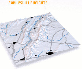 Places with similar names to Earlysville Heights, United States - USA :: Disclaimer :: Information on this page comes without warranty of any kind |
||
|
Where is Earlysville Heights? Elevation and coordinates ::
Latitude (lat): 38°9'10"N Longitude (lon): 78°28'43"W
Elevation (approx.): 194m (map arrows pan, magnifying glasses zoom) |
||
|
Visiting Earlysville Heights? Hotel/Accommodation ::
Book a hotel in Earlysville Heights Travel Guide ::
rental cars ::
car rental offers GPS waypoint ::
download a GPX waypoint (PoI) of Earlysville Heights for your GPS receiver
|
||