|
search place name
|
||
Gholsonville (Virginia, United States - USA)Gholsonville is a town in the Virginia region of United States - USA. An overview map of the region around Gholsonville is displayed below.
regional and 3d topo map of Gholsonville, United States - USA ::

Gholsonville airports ::
The nearest airport is RIC - Richmond Intl, located 108.1 km north east of Gholsonville.
Other airports nearby include RDU - Raleigh-durham Raleigh Durham Intl (117.1 km south west), PHF - Newport News Williamsburg Intl (136.1 km north east), LFI - Hampton Langley Afb (145.2 km east), GSB - Goldsboro Seymour Johnson Afb (145.3 km south), Nearby towns ::
Brunswick (2.2km east) //
Ankum (5.1km south) //
Hicks Mill (5.3km north west) //
Ezell (6.3km north east) //
White Plains (5.6km west) //
Merchant (6.1km north west) //
Bowers Corner (6.0km west) //
Fort Christanna (7.6km north) //
Watkins Corner (7.2km north west) //
Pea Hill Shores (7.9km south) //
Diamond Grove (7.7km north west) //
Pea Hill Estates (9.2km south) //
Valentines (8.8km south east) //
[all distances 'as the bird flies' and approximate] 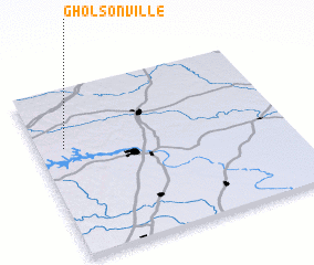 Places with similar names to Gholsonville, United States - USA :: Disclaimer :: Information on this page comes without warranty of any kind |
||
|
Where is Gholsonville? Elevation and coordinates ::
Latitude (lat): 36°38'51"N Longitude (lon): 77°53'44"W
Elevation (approx.): 112m (map arrows pan, magnifying glasses zoom) |
||
|
Visiting Gholsonville? Hotel/Accommodation ::
Book a hotel in Gholsonville Travel Guide ::
rental cars ::
car rental offers GPS waypoint ::
download a GPX waypoint (PoI) of Gholsonville for your GPS receiver
|
||