|
search place name
|
||
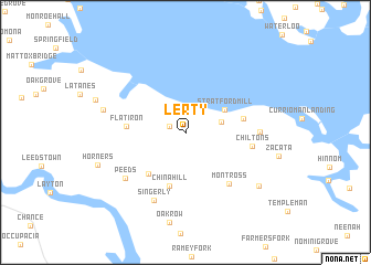
Lerty (Virginia, United States - USA)Lerty is a town in the Virginia region of United States - USA. An overview map of the region around Lerty is displayed below.
regional and 3d topo map of Lerty, United States - USA ::
Lerty airports ::
The nearest airport is NHK - Patuxent River Nas, located 43.0 km east of Lerty.
Other airports nearby include ADW - Camp Springs Andrews Afb (Washington Dc Naf) (74.2 km north), DCA - Ronald Reagan Washington Natl (80.2 km north), RIC - Richmond Intl (81.1 km south west), IAD - Washington Dulles Intl (102.8 km north west), Nearby towns ::
Baynesville (1.5km north west) //
Stratford Hall (3.1km east) //
Stratford Mill (3.9km north east) //
Foneswood (5.1km south west) //
China Hill (5.6km south) //
Flat Iron (4.7km west) //
Bryant Town (4.8km east) //
Montross (6.3km south east) //
Chiltons (5.5km east) //
Chisford (5.9km east) //
Singerly (7.3km south) //
Peeds (6.7km south west) //
Potomac Mills (6.9km west) //
East End (7.9km south east) //
Horners (7.7km south west) //
[all distances 'as the bird flies' and approximate] 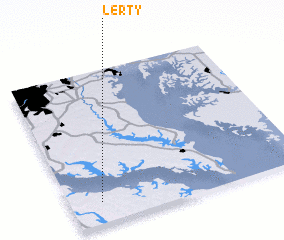 Places with similar names to Lerty, United States - USA ::
Disclaimer :: Information on this page comes without warranty of any kind |
||
|
Where is Lerty? Elevation and coordinates ::
Latitude (lat): 38°8'31"N Longitude (lon): 76°52'4"W
Elevation (approx.): 57m (map arrows pan, magnifying glasses zoom) |
||
|
Visiting Lerty? Hotel/Accommodation ::
Book a hotel in Lerty Travel Guide ::
rental cars ::
car rental offers GPS waypoint ::
download a GPX waypoint (PoI) of Lerty for your GPS receiver
|
||