|
search place name
|
||
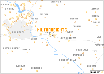
Milton Heights (Virginia, United States - USA)Milton Heights is a town in the Virginia region of United States - USA. An overview map of the region around Milton Heights is displayed below.
regional and 3d topo map of Milton Heights, United States - USA ::
Milton Heights airports ::
The nearest airport is RIC - Richmond Intl, located 109.4 km south east of Milton Heights.
Other airports nearby include IAD - Washington Dulles Intl (132.0 km north east), DCA - Ronald Reagan Washington Natl (150.6 km north east), ADW - Camp Springs Andrews Afb (Washington Dc Naf) (160.0 km north east), EKN - Elkins Randolph Co Jennings Randolph (161.3 km north west), Nearby towns ::
Shadwell Estates (0.6km north west) //
Glenmore (0.7km east) //
Royal Acres (0.8km north east) //
Shadwell (0.9km north west) //
Everettsville (1.3km north east) //
Milton (1.3km west) //
Milton Hills (2.5km south west) //
Running Deer (2.6km south east) //
Ashmere (3.2km south west) //
Keswick (3.0km north east) //
Shadwell Mountain (3.2km north west) //
Rose Hill (3.2km south west) //
Hunters Hall (3.2km west) //
Sleepy Hollow Mobile Home Park (3.4km west) //
Glenorchy (4.5km north west) //
Ashcroft (5.0km north west) //
Mechunk Acres (5.1km east) //
Simeon (5.3km west) //
Rugby (5.3km east) //
Franklin (6.2km north west) //
Eastham (7.4km north) //
Key West (7.2km north west) //
Riverrun (8.1km north west) //
Rio Heights (7.9km north west) //
Pen Park (8.1km north west) //
Village Square (8.4km north west) //
Wildwood (8.2km north west) //
Stonehenge (8.4km north west) //
Cismont (8.6km north east) //
[all distances 'as the bird flies' and approximate] 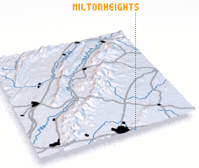 Places with similar names to Milton Heights, United States - USA ::
// Moulton Heights (US)
Disclaimer :: Information on this page comes without warranty of any kind |
||
|
Where is Milton Heights? Elevation and coordinates ::
Latitude (lat): 38°0'27"N Longitude (lon): 78°23'17"W
Elevation (approx.): 122m (map arrows pan, magnifying glasses zoom) |
||
|
Visiting Milton Heights? Hotel/Accommodation ::
Book a hotel in Milton Heights Travel Guide ::
rental cars ::
car rental offers GPS waypoint ::
download a GPX waypoint (PoI) of Milton Heights for your GPS receiver
|
||