|
search place name
|
||
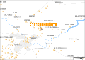
Montrose Heights (Virginia, United States - USA)Montrose Heights is a town in the Virginia region of United States - USA. An overview map of the region around Montrose Heights is displayed below.
regional and 3d topo map of Montrose Heights, United States - USA ::
Montrose Heights airports ::
The nearest airport is RIC - Richmond Intl, located 156.5 km east of Montrose Heights.
Other airports nearby include EKN - Elkins Randolph Co Jennings Randolph (172.8 km north west), RDU - Raleigh-durham Raleigh Durham Intl (177.2 km south), INT - Winston-salem Smith Reynolds (178.3 km south west), IAD - Washington Dulles Intl (218.4 km north east), Nearby towns ::
Edgewood (0.5km south west) //
Old Stage Run (0.9km north west) //
Sandusky Park (0.9km west) //
Melwood Manor (1.2km north west) //
Wright Shop (1.5km south) //
Viking Fiord (1.4km west) //
West Bethel (1.6km north west) //
Williamsburg Manor (1.9km north west) //
Sandy Bottom (2.5km south) //
Lamont Acres (2.6km north) //
City Gomingo (2.9km south) //
Glenwood (3.0km north west) //
Lakeview (3.0km south west) //
Martins Store (3.0km west) //
Holiday Acres (3.5km north west) //
Great Oaks (3.1km west) //
Magruder Hills (3.2km west) //
Prices Store (3.6km north west) //
Brightwell Mill (3.5km east) //
Martins Shop (4.0km north east) //
Madison Heights (4.3km south west) //
Ruritan (4.7km north west) //
Colony (5.4km south west) //
Joshua Falls (5.1km south east) //
Ivanhoe Forest (5.0km north west) //
West Briar (5.3km north west) //
Merry Moor (5.5km south west) //
Meadowview Hills (5.5km north west) //
Monroe (6.2km north west) //
[all distances 'as the bird flies' and approximate] 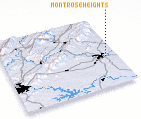 Places with similar names to Montrose Heights, United States - USA ::
// Montrose Heights (US)
Disclaimer :: Information on this page comes without warranty of any kind |
||
|
Where is Montrose Heights? Elevation and coordinates ::
Latitude (lat): 37°27'23"N Longitude (lon): 79°5'15"W
Elevation (approx.): 257m (map arrows pan, magnifying glasses zoom) |
||
|
Visiting Montrose Heights? Hotel/Accommodation ::
Book a hotel in Montrose Heights Travel Guide ::
rental cars ::
car rental offers GPS waypoint ::
download a GPX waypoint (PoI) of Montrose Heights for your GPS receiver
|
||