|
search place name
|
||
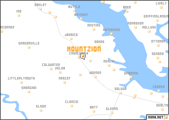
Mount Zion (Virginia, United States - USA)Mount Zion is a town in the Virginia region of United States - USA. An overview map of the region around Mount Zion is displayed below.
regional and 3d topo map of Mount Zion, United States - USA ::
Mount Zion airports ::
The nearest airport is RIC - Richmond Intl, located 60.5 km west of Mount Zion.
Other airports nearby include PHF - Newport News Williamsburg Intl (61.9 km south), LFI - Hampton Langley Afb (70.8 km south east), NHK - Patuxent River Nas (71.8 km north), NGU - Norfolk Ns (88.1 km south), Nearby towns ::
Revis (1.1km east) //
Church View (1.2km north west) //
Farley Park Corner (3.4km south) //
Warner (4.2km south east) //
Samos (4.1km north east) //
Remlik (4.4km east) //
Jamaica (5.3km north west) //
Velma (5.1km south west) //
Mascot (6.1km south west) //
Pine Tree (5.6km south east) //
Nesting (7.1km north) //
Coldwater (6.2km west) //
Water View (7.5km north east) //
Saluda (9.7km south east) //
[all distances 'as the bird flies' and approximate] 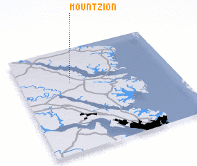 Places with similar names to Mount Zion, United States - USA ::
// Monte-Sano (US)
// Mount Sinai (US)
// Mount Sinai (US)
// Mount Zion (US)
// Mount Zion (US)
// Mount Zion (US)
// Mount Zion (US)
// Mount Zion (US)
// Mount Zion (US)
// Mendocino (US)
Disclaimer :: Information on this page comes without warranty of any kind |
||
|
Where is Mount Zion? Elevation and coordinates ::
Latitude (lat): 37°40'19"N Longitude (lon): 76°40'3"W
Elevation (approx.): 33m (map arrows pan, magnifying glasses zoom) |
||
|
Visiting Mount Zion? Hotel/Accommodation ::
Book a hotel in Mount Zion Travel Guide ::
rental cars ::
car rental offers GPS waypoint ::
download a GPX waypoint (PoI) of Mount Zion for your GPS receiver
|
||