|
search place name
|
||
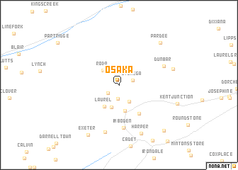
Osaka (Virginia, United States - USA)Osaka is a town in the Virginia region of United States - USA. An overview map of the region around Osaka is displayed below.
regional and 3d topo map of Osaka, United States - USA ::
Osaka airports ::
The nearest airport is TYS - Knoxville Mc Ghee Tyson, located 164.8 km south west of Osaka.
Other airports nearby include HKY - Hickory Rgnl (184.9 km south east), CLT - Charlotte Douglas Intl (255.5 km south east), Nearby towns ::
Derby (1.9km south west) //
Arno (2.2km south) //
Stonega (1.9km east) //
Andover (2.9km south east) //
Roda (3.0km north west) //
Linden (3.6km south) //
Laurel (3.8km south west) //
Inman (4.1km south) //
Appalachia (5.2km south east) //
Imboden (6.7km south) //
Dunbar (6.4km north east) //
Lower Exeter (7.6km south) //
Harper (8.2km south) //
Roaring Fork (7.2km east) //
Exeter (8.8km south west) //
Pardee (8.5km north east) //
Big Stone Gap (9.2km south east) //
Beamantown (9.7km south east) //
[all distances 'as the bird flies' and approximate] 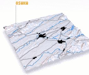 Places with similar names to Osaka, United States - USA ::
Disclaimer :: Information on this page comes without warranty of any kind |
||
|
Where is Osaka? Elevation and coordinates ::
Latitude (lat): 36°56'49"N Longitude (lon): 82°48'39"W
Elevation (approx.): 554m (map arrows pan, magnifying glasses zoom) |
||
|
Visiting Osaka? Hotel/Accommodation ::
Book a hotel in Osaka Travel Guide ::
rental cars ::
car rental offers GPS waypoint ::
download a GPX waypoint (PoI) of Osaka for your GPS receiver
|
||