|
search place name
|
||
Stepney Plantation (Virginia, United States - USA)Stepney Plantation is a town in the Virginia region of United States - USA. An overview map of the region around Stepney Plantation is displayed below.
regional and 3d topo map of Stepney Plantation, United States - USA ::

Stepney Plantation airports ::
The nearest airport is IAD - Washington Dulles Intl, located 15.8 km north east of Stepney Plantation.
Other airports nearby include DCA - Ronald Reagan Washington Natl (49.6 km east), ADW - Camp Springs Andrews Afb (Washington Dc Naf) (64.7 km east), BWI - Baltimore Washington Intl (88.3 km north east), NHK - Patuxent River Nas (122.6 km south east), Nearby towns ::
Snow Hill (1.0km south west) //
Lawnvale Estates (1.2km south) //
Gypsum Hill Estates (1.0km north west) //
Woolsey (2.4km west) //
Old Field Estates (2.5km south east) //
Bushy Acres (3.4km south) //
Olde South Estates (3.0km east) //
Breezy Knolls Estates (3.0km east) //
Catharpin Farms (3.2km south east) //
Long Level Estates (3.9km south) //
Hickory Grove Acres (4.2km north) //
Catharpin (3.4km south east) //
Mill Creek Estates (3.4km north west) //
Catharpin Farms Estates (4.1km south east) //
Hickory Grove (4.1km north west) //
Forest Hills Estates (3.7km north east) //
Boxwood Farms (3.8km east) //
New Hope Forest (4.3km west) //
Mountain View Estates (4.7km west) //
Crescent (4.6km west) //
Sudley Mountain Estates (5.4km south east) //
Waterfall Village (5.3km west) //
Haymarket (6.5km south) //
Evergreen Farms (5.5km west) //
Waterfall (5.5km west) //
Bull Run Mountain Estates (6.2km north west) //
Knollwood Estates (6.1km west) //
Gainesville (7.9km south) //
Forest Lake Estates (7.5km north west) //
[all distances 'as the bird flies' and approximate] 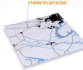 Places with similar names to Stepney Plantation, United States - USA :: Disclaimer :: Information on this page comes without warranty of any kind |
||
|
Where is Stepney Plantation? Elevation and coordinates ::
Latitude (lat): 38°51'58"N Longitude (lon): 77°36'30"W
Elevation (approx.): 120m (map arrows pan, magnifying glasses zoom) |
||
|
Visiting Stepney Plantation? Hotel/Accommodation ::
Book a hotel in Stepney Plantation Travel Guide ::
rental cars ::
car rental offers GPS waypoint ::
download a GPX waypoint (PoI) of Stepney Plantation for your GPS receiver
|
||