|
search place name
|
||
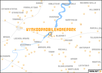
Wynkoop Mobile Home Park (Virginia, United States - USA)Wynkoop Mobile Home Park is a town in the Virginia region of United States - USA. An overview map of the region around Wynkoop Mobile Home Park is displayed below.
regional and 3d topo map of Wynkoop Mobile Home Park, United States - USA ::
Wynkoop Mobile Home Park airports ::
The nearest airport is IAD - Washington Dulles Intl, located 40.7 km south east of Wynkoop Mobile Home Park.
Other airports nearby include DCA - Ronald Reagan Washington Natl (77.9 km east), ADW - Camp Springs Andrews Afb (Washington Dc Naf) (93.3 km east), BWI - Baltimore Washington Intl (104.0 km east), AOO - Altoona Blair Co (136.3 km north), Nearby towns ::
Pine Grove (0.3km east) //
Longwood (0.6km west) //
Horse Shoe Curve (0.9km east) //
Shenandoah Retreat (1.7km north) //
Spout Run (2.3km south west) //
Castlemans Ferry (1.9km west) //
Bluemont (3.1km east) //
Valley View (3.6km east) //
Murphys Corner (4.1km east) //
Arcadia Farm (4.1km west) //
Barker Land (5.3km south) //
Top Hill (4.7km south west) //
Wickliffe (5.6km north) //
Blue Ridge Estates (5.0km north west) //
Riverside (6.1km north) //
Chilly Hollow Estates (5.0km west) //
Vista Estates (5.3km west) //
Trapp (6.8km south) //
Littletown (6.8km south) //
Paxson (5.9km south east) //
Rock Hill (6.8km south east) //
Ashby Run (7.3km south west) //
Webbtown (6.8km west) //
Bloomfield (8.4km south east) //
Sunny Ridge (7.8km north east) //
Frogtown (8.1km south west) //
Willow Lake (8.3km south west) //
Gaylord (9.3km north west) //
Mountain Lake (9.0km south west) //
[all distances 'as the bird flies' and approximate] 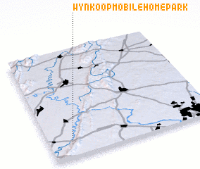 Places with similar names to Wynkoop Mobile Home Park, United States - USA :: Disclaimer :: Information on this page comes without warranty of any kind |
||
|
Where is Wynkoop Mobile Home Park? Elevation and coordinates ::
Latitude (lat): 39°7'8"N Longitude (lon): 77°52'8"W
Elevation (approx.): 195m (map arrows pan, magnifying glasses zoom) |
||
|
Visiting Wynkoop Mobile Home Park? Hotel/Accommodation ::
Book a hotel in Wynkoop Mobile Home Park Travel Guide ::
rental cars ::
car rental offers GPS waypoint ::
download a GPX waypoint (PoI) of Wynkoop Mobile Home Park for your GPS receiver
|
||