|
search place name
|
||
Kennydale (Washington, United States - USA)Kennydale is a town in the Washington region of United States - USA. An overview map of the region around Kennydale is displayed below.
regional and 3d topo map of Kennydale, United States - USA ::

Kennydale airports ::
The nearest airport is BFI - Seattle Boeing Fld King Co Intl, located 7.3 km west of Kennydale.
Other airports nearby include SEA - Seattle Tacoma Intl (11.2 km south west), PAE - Everett Snohomish Co (43.2 km north), TCM - Tacoma Mc Chord Afb (47.3 km south west), GRF - Fort Lewis Gray Aaf (56.7 km south west), Nearby towns ::
May Creek (1.3km north) //
Pines (3.0km north east) //
Bryn Mawr (2.7km south west) //
Hazelwood (3.6km north) //
Highlands Park (3.4km south east) //
Newport Hills (3.2km north east) //
Renton (4.3km south) //
Lakeridge (3.2km south west) //
Lake Heights (4.6km north) //
Tamill (3.5km west) //
Rainier Beach (3.9km west) //
Newport Shores (5.7km north) //
Mercer Island (5.7km north) //
Newcastle (4.3km north east) //
Mercer Heights (5.8km north) //
Skyway (4.8km south west) //
Newport (6.0km north) //
Fortuna (6.8km north) //
Dunlap (4.9km west) //
Beaux Arts Village (7.1km north) //
Eastgate (6.3km north east) //
Somerset (6.2km north east) //
Maplewood (6.7km south east) //
Beaumont (7.7km north) //
Tukwila (6.6km south west) //
Hilltop (6.1km north east) //
Factoria (7.4km north east) //
Mercer Island Town (7.6km north) //
Brighton (5.9km north west) //
[all distances 'as the bird flies' and approximate] 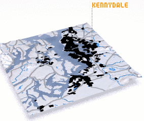 Places with similar names to Kennydale, United States - USA ::
Disclaimer :: Information on this page comes without warranty of any kind |
||
|
Where is Kennydale? Elevation and coordinates ::
Latitude (lat): 47°31'15"N Longitude (lon): 122°12'20"W
Elevation (approx.): 37m (map arrows pan, magnifying glasses zoom) |
||
|
Visiting Kennydale? Hotel/Accommodation ::
Book a hotel in Kennydale Travel Guide ::
rental cars ::
car rental offers GPS waypoint ::
download a GPX waypoint (PoI) of Kennydale for your GPS receiver
|
||