|
search place name
|
||
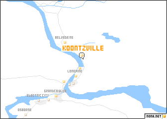
Koontzville (Washington, United States - USA)Koontzville is a town in the Washington region of United States - USA. An overview map of the region around Koontzville is displayed below.
regional and 3d topo map of Koontzville, United States - USA ::
Koontzville airports ::
The nearest airport is SKA - Spokane Fairchild Afb, located 106.4 km south east of Koontzville.
Other airports nearby include GEG - Spokane Intl (114.6 km east), SFF - Spokane Felts Fld (127.0 km east), YYF - Penticton (168.0 km north), YCG - Castlegar (172.2 km north east), Nearby towns ::
Seatons Grove (0.9km north) //
Elmer City (2.0km south) //
Lone Pine (3.9km south) //
Belvedere (4.7km north west) //
Mason City (5.7km south) //
Coulee Dam (6.0km south) //
Crown Point Vista (5.8km south west) //
Grand Coulee (9.2km south west) //
[all distances 'as the bird flies' and approximate] 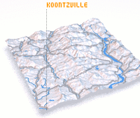 Places with similar names to Koontzville, United States - USA ::
Disclaimer :: Information on this page comes without warranty of any kind |
||
|
Where is Koontzville? Elevation and coordinates ::
Latitude (lat): 48°0'57"N Longitude (lon): 118°56'46"W
Elevation (approx.): 322m (map arrows pan, magnifying glasses zoom) |
||
|
Visiting Koontzville? Hotel/Accommodation ::
Book a hotel in Koontzville Travel Guide ::
rental cars ::
car rental offers GPS waypoint ::
download a GPX waypoint (PoI) of Koontzville for your GPS receiver
|
||