|
search place name
|
||
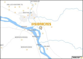
Vision Acres (Washington, United States - USA)Vision Acres is a town in the Washington region of United States - USA. An overview map of the region around Vision Acres is displayed below.
regional and 3d topo map of Vision Acres, United States - USA ::
Vision Acres airports ::
The nearest airport is PDX - Portland Intl, located 59.2 km south of Vision Acres.
Other airports nearby include MMV - Mackminnville Mc Minnville Muni (101.5 km south), GRF - Fort Lewis Gray Aaf (112.4 km north), TCM - Tacoma Mc Chord Afb (120.5 km north), SEA - Seattle Tacoma Intl (157.2 km north), Nearby towns ::
Carrolls (1.8km south) //
Longview Junction (2.5km north west) //
Lindbergh (3.3km south west) //
Rose Valley (3.3km east) //
Prescott (4.5km south) //
Davis Terrace (5.7km north west) //
Rainier (5.3km west) //
Goble (8.0km south) //
Kelso (7.3km north west) //
Reuben (8.8km south) //
West Kelso (7.8km north west) //
Kalama (8.9km south) //
Longview (7.9km north west) //
Columbia Heights (10.3km north west) //
[all distances 'as the bird flies' and approximate]  Places with similar names to Vision Acres, United States - USA :: Disclaimer :: Information on this page comes without warranty of any kind |
||
|
Where is Vision Acres? Elevation and coordinates ::
Latitude (lat): 46°5'15"N Longitude (lon): 122°51'58"W
Elevation (approx.): 49m (map arrows pan, magnifying glasses zoom) |
||
|
Visiting Vision Acres? Hotel/Accommodation ::
Book a hotel in Vision Acres Travel Guide ::
rental cars ::
car rental offers GPS waypoint ::
download a GPX waypoint (PoI) of Vision Acres for your GPS receiver
|
||