|
search place name
|
||
Bentree (West Virginia, United States - USA)Bentree is a town in the West Virginia region of United States - USA. An overview map of the region around Bentree is displayed below.
regional and 3d topo map of Bentree, United States - USA ::

Bentree airports ::
The nearest airport is EKN - Elkins Randolph Co Jennings Randolph, located 134.3 km north east of Bentree.
Other airports nearby include LCK - Columbus Rickenbacker Intl (226.8 km north west), CMH - Port Columbus Intl (240.5 km north west), Nearby towns ::
Cambria (2.2km south) //
Independence (3.5km north) //
Dixie (3.7km south) //
Greendale (3.5km east) //
Crosby (4.4km north) //
Vaughan (4.1km east) //
Adonijah (5.6km north) //
Belva (5.8km south) //
Lizemores (5.8km north) //
Mount Olive (6.3km south west) //
Beech Glen (7.0km south east) //
Jodie (7.0km south east) //
Wyndal (7.7km south) //
Bryce (7.6km south east) //
Alta (8.6km south) //
Swiss (7.9km south east) //
Indore (8.6km north east) //
Agnew (9.0km south east) //
[all distances 'as the bird flies' and approximate] 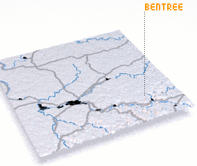 Places with similar names to Bentree, United States - USA ::
// Beni Idder (MA)
// Beni Idir (MA)
// Beni Idir (MA)
// Bou Antar (MA)
// Boû Ouentere (MA)
// Bandīra (ET)
// Bander (ET)
// Bañadero (PH)
// Bañadero (PH)
// Bañadero (PH)
Disclaimer :: Information on this page comes without warranty of any kind |
||
|
Where is Bentree? Elevation and coordinates ::
Latitude (lat): 38°17'1"N Longitude (lon): 81°11'28"W
Elevation (approx.): 315m (map arrows pan, magnifying glasses zoom) |
||
|
Visiting Bentree? Hotel/Accommodation ::
Book a hotel in Bentree Travel Guide ::
rental cars ::
car rental offers GPS waypoint ::
download a GPX waypoint (PoI) of Bentree for your GPS receiver
|
||