|
search place name
|
||
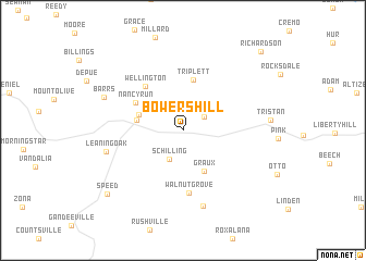
Bowers Hill (West Virginia, United States - USA)Bowers Hill is a town in the West Virginia region of United States - USA. An overview map of the region around Bowers Hill is displayed below.
regional and 3d topo map of Bowers Hill, United States - USA ::
Bowers Hill airports ::
The nearest airport is EKN - Elkins Randolph Co Jennings Randolph, located 126.4 km east of Bowers Hill.
Other airports nearby include LCK - Columbus Rickenbacker Intl (179.9 km north west), CMH - Port Columbus Intl (191.1 km north west), PIT - Pittsburgh (pennsylva) Pittsburgh Intl (210.0 km north east), Nearby towns ::
Morford (2.1km north east) //
Schilling (3.2km south) //
Graux (4.6km south) //
Alvord (3.9km north west) //
Spencer (3.9km west) //
Triplett (5.3km north) //
Nancy Run (4.7km north west) //
Wellington (5.4km north west) //
Walnut Grove (6.4km south) //
Clover (7.9km south) //
Leaning Oak (6.5km west) //
Barrs (7.1km north west) //
Speed (8.9km south west) //
Richardson (10.2km north east) //
[all distances 'as the bird flies' and approximate] 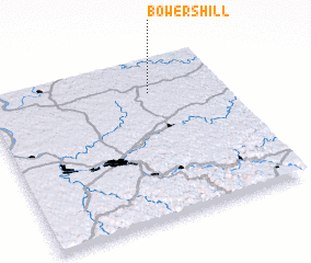 Places with similar names to Bowers Hill, United States - USA ::
Disclaimer :: Information on this page comes without warranty of any kind |
||
|
Where is Bowers Hill? Elevation and coordinates ::
Latitude (lat): 38°47'34"N Longitude (lon): 81°18'29"W
Elevation (approx.): 325m (map arrows pan, magnifying glasses zoom) |
||
|
Visiting Bowers Hill? Hotel/Accommodation ::
Book a hotel in Bowers Hill Travel Guide ::
rental cars ::
car rental offers GPS waypoint ::
download a GPX waypoint (PoI) of Bowers Hill for your GPS receiver
|
||