|
search place name
|
||
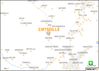
Cirtsville (West Virginia, United States - USA)Cirtsville is a town in the West Virginia region of United States - USA. An overview map of the region around Cirtsville is displayed below.
regional and 3d topo map of Cirtsville, United States - USA ::
Cirtsville airports ::
The nearest airport is EKN - Elkins Randolph Co Jennings Randolph, located 166.4 km north east of Cirtsville.
Other airports nearby include INT - Winston-salem Smith Reynolds (215.1 km south east), LCK - Columbus Rickenbacker Intl (258.5 km north west), Nearby towns ::
Willis Branch (1.4km north) //
Weirwood (1.5km north) //
Maynor (1.7km south) //
Pax (3.2km north) //
Maple Fork (3.3km east) //
Packs Branch (3.8km north east) //
Long Branch (4.7km north) //
Sweeneyburg (5.1km south) //
Lively (6.6km north) //
James Crest Farms (7.5km south east) //
Bradley (6.6km east) //
Price Hill (6.7km east) //
Prosperity (7.5km south east) //
Dry Hill (8.4km south east) //
Harper Heights (8.9km south) //
Morgan Hills (8.7km south) //
Matville (8.1km south west) //
Clear Creek (7.9km north west) //
Pine Hills (9.1km south east) //
Cranberry (9.1km south east) //
Skelton (10.5km south east) //
[all distances 'as the bird flies' and approximate]  Places with similar names to Cirtsville, United States - USA ::
// Sarrūd-e Soflá (IR)
// Sortosville (FR)
Disclaimer :: Information on this page comes without warranty of any kind |
||
|
Where is Cirtsville? Elevation and coordinates ::
Latitude (lat): 37°52'53"N Longitude (lon): 81°15'58"W
Elevation (approx.): 506m (map arrows pan, magnifying glasses zoom) |
||
|
Visiting Cirtsville? Hotel/Accommodation ::
Book a hotel in Cirtsville Travel Guide ::
rental cars ::
car rental offers GPS waypoint ::
download a GPX waypoint (PoI) of Cirtsville for your GPS receiver
|
||