|
search place name
|
||
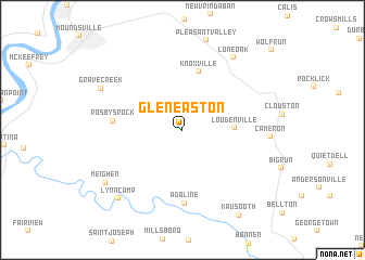
Glen Easton (West Virginia, United States - USA)Glen Easton is a town in the West Virginia region of United States - USA. An overview map of the region around Glen Easton is displayed below.
regional and 3d topo map of Glen Easton, United States - USA ::
Glen Easton airports ::
The nearest airport is PIT - Pittsburgh (pennsylva) Pittsburgh Intl, located 81.2 km north east of Glen Easton.
Other airports nearby include EKN - Elkins Randolph Co Jennings Randolph (125.0 km south east), AKR - Akron Fulton Intl (150.7 km north west), YNG - Youngstown Warren Rgnl (158.5 km north), CLE - Cleveland Hopkins Intl (202.6 km north west), Nearby towns ::
Loudenville (4.2km east) //
Knoxville (6.2km north) //
Rosbys Rock (5.5km west) //
Adaline (7.6km south) //
Lone Oak (8.5km north east) //
Grave Creek (7.7km north west) //
Meighen (8.1km south west) //
Lynn Camp (8.7km south west) //
Kausooth (9.9km south east) //
[all distances 'as the bird flies' and approximate] 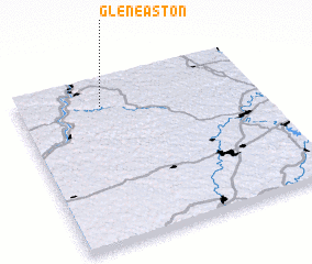 Places with similar names to Glen Easton, United States - USA ::
// Kühlenstein (DE)
// Glen Austin (ZA)
// Collinston (US)
// Collinstown (US)
// Collinstown (US)
// Collinston (US)
// Collinstown (IE)
// Cullenstown (IE)
Disclaimer :: Information on this page comes without warranty of any kind |
||
|
Where is Glen Easton? Elevation and coordinates ::
Latitude (lat): 39°50'0"N Longitude (lon): 80°38'54"W
Elevation (approx.): 290m (map arrows pan, magnifying glasses zoom) |
||
|
Visiting Glen Easton? Hotel/Accommodation ::
Book a hotel in Glen Easton Travel Guide ::
rental cars ::
car rental offers GPS waypoint ::
download a GPX waypoint (PoI) of Glen Easton for your GPS receiver
|
||