|
search place name
|
||
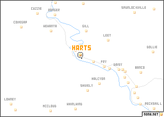
Harts (West Virginia, United States - USA)Harts is a town in the West Virginia region of United States - USA. An overview map of the region around Harts is displayed below.
regional and 3d topo map of Harts, United States - USA ::
Harts airports ::
The nearest airport is LCK - Columbus Rickenbacker Intl, located 209.7 km north of Harts.
Other airports nearby include CMH - Port Columbus Intl (228.1 km north), FFO - Dayton Wright Patterson Afb (259.6 km north west), INT - Winston-salem Smith Reynolds (270.4 km south east), Nearby towns ::
Atenville (2.2km north west) //
Ferrellsburg (2.2km east) //
Fry (4.4km south east) //
Gill (6.3km north) //
Toney (5.4km south east) //
Halcyon (6.5km south east) //
Leet (6.3km north east) //
Shively (7.3km south) //
Daisy (7.1km east) //
Wewanta (8.4km north west) //
[all distances 'as the bird flies' and approximate] 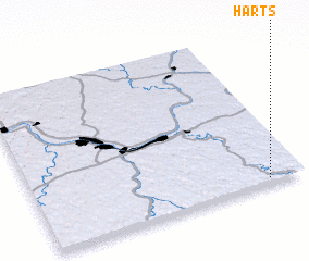 Places with similar names to Harts, United States - USA ::
Disclaimer :: Information on this page comes without warranty of any kind |
||
|
Where is Harts? Elevation and coordinates ::
Latitude (lat): 38°1'52"N Longitude (lon): 82°7'46"W
Elevation (approx.): 191m (map arrows pan, magnifying glasses zoom) |
||
|
Visiting Harts? Hotel/Accommodation ::
Book a hotel in Harts Travel Guide ::
rental cars ::
car rental offers GPS waypoint ::
download a GPX waypoint (PoI) of Harts for your GPS receiver
|
||