|
search place name
|
||
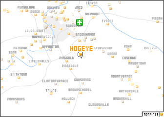
Hog Eye (West Virginia, United States - USA)Hog Eye is a town in the West Virginia region of United States - USA. An overview map of the region around Hog Eye is displayed below.
regional and 3d topo map of Hog Eye, United States - USA ::
Hog Eye airports ::
The nearest airport is EKN - Elkins Randolph Co Jennings Randolph, located 75.6 km south of Hog Eye.
Other airports nearby include PIT - Pittsburgh (pennsylva) Pittsburgh Intl (106.0 km north), AOO - Altoona Blair Co (158.3 km north east), YNG - Youngstown Warren Rgnl (198.8 km north), AKR - Akron Fulton Intl (209.9 km north west), Nearby towns ::
Ringgold (2.7km west) //
Ridgedale (3.2km south west) //
Rock Forge (4.0km north) //
Richard (4.2km north) //
Dellslow (4.5km north) //
Brookhaven (4.8km north) //
Sturgisson (4.1km north east) //
Pioneer Rocks (5.0km north east) //
West Sabraton (5.5km north) //
Gum Spring (5.7km south) //
South Hills (6.1km north west) //
Sabraton (6.8km north) //
Greer (5.4km east) //
Uffington (5.8km west) //
Browns Chapel (7.9km south) //
Morgantown (7.7km north west) //
The Mileground (8.3km north) //
Clinton Furnace (7.5km south west) //
Chestnut Ridge (9.2km north) //
Park Hills (9.2km north) //
Harmony Grove (7.9km north west) //
Westover (8.8km north west) //
Tyrone (9.1km north east) //
Riverside (9.4km north west) //
Evansdale (9.9km north west) //
Triune (9.7km south west) //
Fairmor (9.4km north west) //
Morgan Heights (9.5km north west) //
Granville (10.7km north west) //
[all distances 'as the bird flies' and approximate]  Places with similar names to Hog Eye, United States - USA ::
Disclaimer :: Information on this page comes without warranty of any kind |
||
|
Where is Hog Eye? Elevation and coordinates ::
Latitude (lat): 39°34'9"N Longitude (lon): 79°54'45"W
Elevation (approx.): 465m (map arrows pan, magnifying glasses zoom) |
||
|
Visiting Hog Eye? Hotel/Accommodation ::
Book a hotel in Hog Eye Travel Guide ::
rental cars ::
car rental offers GPS waypoint ::
download a GPX waypoint (PoI) of Hog Eye for your GPS receiver
|
||