|
search place name
|
||
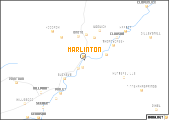
Marlinton (West Virginia, United States - USA)Marlinton is a town in the West Virginia region of United States - USA. An overview map of the region around Marlinton is displayed below.
regional and 3d topo map of Marlinton, United States - USA ::
Marlinton airports ::
The nearest airport is EKN - Elkins Randolph Co Jennings Randolph, located 76.8 km north of Marlinton.
Nearby towns ::
Stillwell (1.7km south) //
Campbelltown (2.1km north) //
Beard Heights (2.1km south west) //
Knapp (4.0km east) //
Brownsburg (5.2km north) //
Onoto (5.4km north) //
Edray (5.7km north) //
Buckeye (5.4km south west) //
Thorny Creek (6.0km north east) //
West Union (6.5km north west) //
Warwick (7.1km north) //
Clawson (7.5km north east) //
Violet (8.5km south west) //
Huntersville (7.9km south east) //
Woodrow (8.5km north west) //
Watoga (10.0km south west) //
[all distances 'as the bird flies' and approximate] 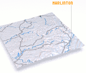 Places with similar names to Marlinton, United States - USA ::
// Marialinden (DE)
// Maria-Linden (ZA)
Disclaimer :: Information on this page comes without warranty of any kind |
||
|
Where is Marlinton? Elevation and coordinates ::
Latitude (lat): 38°13'24"N Longitude (lon): 80°5'41"W
Elevation (approx.): 646m (map arrows pan, magnifying glasses zoom) |
||
|
Visiting Marlinton? Hotel/Accommodation ::
Book a hotel in Marlinton Travel Guide ::
rental cars ::
car rental offers GPS waypoint ::
download a GPX waypoint (PoI) of Marlinton for your GPS receiver
|
||