|
search place name
|
||
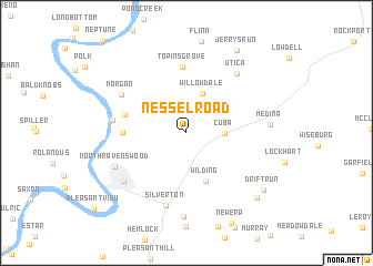
Nesselroad (West Virginia, United States - USA)Nesselroad is a town in the West Virginia region of United States - USA. An overview map of the region around Nesselroad is displayed below.
regional and 3d topo map of Nesselroad, United States - USA ::
Nesselroad airports ::
The nearest airport is LCK - Columbus Rickenbacker Intl, located 139.4 km north west of Nesselroad.
Other airports nearby include CMH - Port Columbus Intl (151.4 km north west), EKN - Elkins Randolph Co Jennings Randolph (160.5 km east), PIT - Pittsburgh (pennsylva) Pittsburgh Intl (208.9 km north east), Nearby towns ::
Cuba (3.0km east) //
Willowdale (4.2km north) //
Wilding (5.1km south) //
Skull Run (5.1km west) //
Sherman (5.0km west) //
Topins Grove (6.6km north) //
Silverton (7.5km south) //
Portland (6.0km west) //
Morgan (6.4km north west) //
Utica (7.1km north east) //
Ravenswood (6.9km south west) //
North Ravenswood (6.6km south west) //
Nuzums (8.4km south) //
Medina (6.6km east) //
Drift Run (8.3km south east) //
Odaville (8.6km south east) //
Jerrys Run (9.3km north east) //
[all distances 'as the bird flies' and approximate] 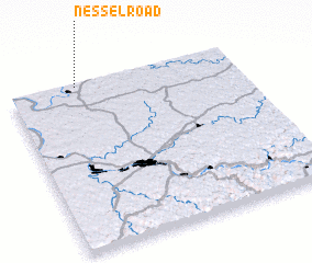 Places with similar names to Nesselroad, United States - USA ::
// Nesselried (DE)
Disclaimer :: Information on this page comes without warranty of any kind |
||
|
Where is Nesselroad? Elevation and coordinates ::
Latitude (lat): 38°59'30"N Longitude (lon): 81°42'15"W
Elevation (approx.): 193m (map arrows pan, magnifying glasses zoom) |
||
|
Visiting Nesselroad? Hotel/Accommodation ::
Book a hotel in Nesselroad Travel Guide ::
rental cars ::
car rental offers GPS waypoint ::
download a GPX waypoint (PoI) of Nesselroad for your GPS receiver
|
||