|
search place name
|
||
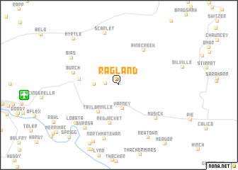
Ragland (West Virginia, United States - USA)Ragland is a town in the West Virginia region of United States - USA. An overview map of the region around Ragland is displayed below.
regional and 3d topo map of Ragland, United States - USA ::
Ragland airports ::
The nearest airport is HKY - Hickory Rgnl, located 227.4 km south of Ragland.
Other airports nearby include INT - Winston-salem Smith Reynolds (243.2 km south east), TYS - Knoxville Mc Ghee Tyson (268.0 km south west), Nearby towns ::
Lando Mines (1.7km west) //
Varney (3.7km south) //
Puritan Mines (3.1km west) //
Taylorville (5.0km south west) //
Red Jacket (6.1km south) //
Delbarton (5.1km west) //
Pine Creek (6.3km north east) //
Burch (6.0km west) //
Musick (7.0km south east) //
Scarlet (8.3km north) //
Surosa (8.0km south west) //
Bias (7.3km north west) //
North Matewan (8.7km south) //
Lobata (8.1km south west) //
Newtown (9.1km south east) //
Myrtle (9.2km north west) //
Sprigg (10.3km south west) //
[all distances 'as the bird flies' and approximate]  Places with similar names to Ragland, United States - USA ::
Disclaimer :: Information on this page comes without warranty of any kind |
||
|
Where is Ragland? Elevation and coordinates ::
Latitude (lat): 37°42'9"N Longitude (lon): 82°7'39"W
Elevation (approx.): 271m (map arrows pan, magnifying glasses zoom) |
||
|
Visiting Ragland? Hotel/Accommodation ::
Book a hotel in Ragland Travel Guide ::
rental cars ::
car rental offers GPS waypoint ::
download a GPX waypoint (PoI) of Ragland for your GPS receiver
|
||