|
search place name
|
||
Naranjales (Puerto Rico, United States - USA)Naranjales is a town in the Puerto Rico region of United States - USA. An overview map of the region around Naranjales is displayed below.
regional and 3d topo map of Naranjales, United States - USA ::

Naranjales airports ::
The nearest airport is MAZ - Mayaguez Eugenio Maria De Hostos, located 16.5 km west of Naranjales.
Other airports nearby include BQN - Aguadilla Rafael Hernandez (34.2 km north west), PSE - Ponce Mercedita (51.4 km south east), SIG - San Juan Fernando Luis Ribas Dominicci (99.0 km east), SJU - San Juan Luis Munoz Marin Intl (108.4 km east), Nearby towns ::
Hacienda La Milagrosa (1.1km north) //
Hacienda Delicias (1.2km south east) //
Hacienda San Antonio (2.4km south) //
Hacienda Retiro (2.8km south west) //
Hacienda Balare (3.1km south east) //
Hacienda Merle (3.1km north west) //
Hacienda Fajardo (3.4km west) //
Hacienda Juanita (3.5km north west) //
Hacienda Teresa (3.5km east) //
Consumo (3.5km west) //
Maricao (3.8km south east) //
Pueblo Nuevo (4.0km south east) //
Hacienda Plato Indio (4.0km north west) //
Hacienda Polmares (4.2km south west) //
Las Vegas (4.3km south west) //
Hacienda Santa Rita (4.6km south east) //
Hacienda Rolon (4.5km south west) //
Las Marias (4.7km north) //
Munoz Torruellas (5.2km north) //
Hacienda Josefa (5.4km east) //
Hacienda Esperanza (5.8km north west) //
Acevedo (6.0km north) //
Hacienda Veremos (5.9km west) //
Hacienda Constancia (6.1km east) //
Hacienda Buena Vista (6.6km north east) //
Hacienda Recurso (7.2km west) //
Hacienda Cipriano (7.5km north west) //
Finca La Corza (7.5km west) //
Limon (8.0km west) //
[all distances 'as the bird flies' and approximate] 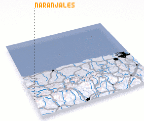 Places with similar names to Naranjales, United States - USA ::
// Naranjales (GT)
// Naranjales (GT)
Disclaimer :: Information on this page comes without warranty of any kind |
||
|
Where is Naranjales? Elevation and coordinates ::
Latitude (lat): 18°12'42"N Longitude (lon): 66°59'57"W
Elevation (approx.): 513m (map arrows pan, magnifying glasses zoom) |
||
|
Visiting Naranjales? Hotel/Accommodation ::
Book a hotel in Naranjales Travel Guide ::
rental cars ::
car rental offers GPS waypoint ::
download a GPX waypoint (PoI) of Naranjales for your GPS receiver
|
||