|
search place name
|
||
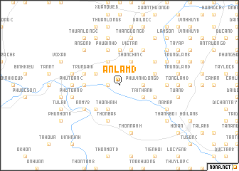
An Lâm (3) (Quảng Nam-Ðà Nẵng, Vietnam)An Lâm (3) is a town in the Quảng Nam-Ðà Nẵng region of Vietnam. An overview map of the region around An Lâm (3) is displayed below.
regional and 3d topo map of An Lâm (3), Vietnam ::
An Lâm (3) airports ::
The nearest airport is DAD - Danang Intl, located 52.8 km north of An Lâm (3).
Nearby towns ::
An Vang (4) (1.8km west) //
An Lâm (1) (1.8km west) //
Phú Vinh Ðông (1) (3.6km east) //
Hòa Lộc (3.6km east) //
Phước Hòa (2) (4.0km north west) //
Ðại Trang Thôn (4.0km south east) //
Tài Thanh (4.0km south east) //
Thôn Chín (2) (4.1km north east) //
An Trang (2) (4.1km north west) //
Thôn Hai (7) (4.1km south west) //
Ðông Bình (5.1km south west) //
An Vinh (2) (5.4km west) //
Thôn Sáu (2) (5.6km north) //
Phú Lâm (1) (5.7km east) //
Trung Ái (1) (5.7km west) //
Ðông Ấp (5.7km east) //
Phú Bình (3) (5.8km north) //
Việt An (5.8km north) //
Thôn Ba (1) (5.8km south) //
Hiên Lộc (3) (6.6km north east) //
Hương Phố (3) (6.5km north east) //
Lộc An (1) (6.5km north east) //
An Mỹ (1) (6.5km south west) //
Phú Trương (1) (7.1km east) //
Phú Toản (2) (7.1km west) //
Thăng Ðông (1) (7.6km north) //
Châu Sơn (1) (7.6km north) //
Hòa Quế (3) (7.4km west) //
Phú Toản (1) (7.4km west) //
[all distances 'as the bird flies' and approximate]  Places with similar names to An Lâm (3), Vietnam ::
// ‘Ayn al ‘Āmūd (SY)
Disclaimer :: Information on this page comes without warranty of any kind |
||
|
Where is An Lâm (3)? Elevation and coordinates ::
Latitude (lat): 15°34'0"N Longitude (lon): 108°12'0"E
Elevation (approx.): 37m (map arrows pan, magnifying glasses zoom) |
||
|
Visiting An Lâm (3)? Hotel/Accommodation ::
Book a hotel in An Lâm (3) Travel Guide ::
Buy a travel guide for Vietnam rental cars ::
car rental offers GPS waypoint ::
download a GPX waypoint (PoI) of An Lâm (3) for your GPS receiver
|
||