|
search place name
|
||
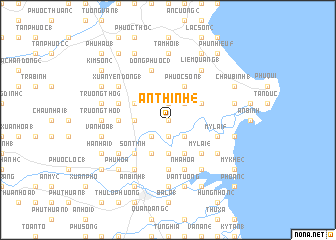
An Thinh (4) (Vietnam)An Thinh (4) is a town in Vietnam. An overview map of the region around An Thinh (4) is displayed below.
regional and 3d topo map of An Thinh (4), Vietnam ::
An Thinh (4) airports ::
The nearest airport is DAD - Danang Intl, located 115.5 km north west of An Thinh (4).
Nearby towns ::
Trường Thọ (2) (0.0km north) //
Châu Sa (3) (1.9km south) //
Trường Thọ (1) (1.9km north) //
Phú Giang (2.6km south west) //
An Thinh (3) (2.6km south east) //
Vạn Thiện (2.6km south east) //
An Thinh (2) (2.6km north east) //
Hương Trà (2) (3.7km south) //
Duyên Phước (1) (3.6km west) //
Phú Mỹ (3) (4.1km south west) //
Châu Thanh (4.1km south east) //
Châu Sa (1) (4.1km south east) //
Phước Sơn (1) (4.1km north east) //
Nhân Hòa (2) (4.1km north east) //
Thế Lợi (1) (4.0km north west) //
Trung Sơn (1) (4.0km north east) //
Sơn Tịnh (5.2km south west) //
Mỹ Lại (4) (5.2km south east) //
An Nhân (5.6km south) //
Ðông Thành (2) (5.4km west) //
Ðông Phước (3) (5.8km north) //
Nha Hòa (5.8km south) //
Mỹ Lại (5) (5.7km east) //
Thế Lợi (4) (5.7km west) //
Mỹ Khê (1) (6.5km south east) //
Mỹ Lộc (6.6km south west) //
Ðông Dương (2) (6.6km south west) //
Phú Ninh (2) (6.5km south west) //
Hà Nhai (1) (6.5km south west) //
[all distances 'as the bird flies' and approximate] 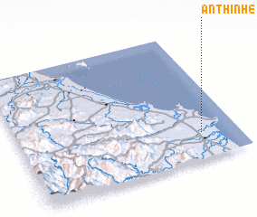 Places with similar names to An Thinh (4), Vietnam :: Disclaimer :: Information on this page comes without warranty of any kind |
||
|
Where is An Thinh (4)? Elevation and coordinates ::
Latitude (lat): 15°12'0"N Longitude (lon): 108°50'0"E
Elevation (approx.): 14m (map arrows pan, magnifying glasses zoom) |
||
|
Visiting An Thinh (4)? Hotel/Accommodation ::
Book a hotel in An Thinh (4) Travel Guide ::
Buy a travel guide for Vietnam rental cars ::
car rental offers GPS waypoint ::
download a GPX waypoint (PoI) of An Thinh (4) for your GPS receiver
|
||