|
search place name
|
||
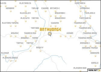
An Thượng (4) (Vietnam)An Thượng (4) is a town in Vietnam. An overview map of the region around An Thượng (4) is displayed below.
regional and 3d topo map of An Thượng (4), Vietnam ::
An Thượng (4) airports ::
The nearest airport is NHA - Nhatrang, located 199.7 km south of An Thượng (4).
Nearby towns ::
An Thượng (1) (1.9km north) //
An Mỹ (2) (2.6km south west) //
An Thượng (5) (3.6km east) //
An Xuan (1) (3.7km north) //
Cựu Ðịnh (4.1km north east) //
Ngoc An (5.4km east) //
Tân Tao (1) (5.7km west) //
An Khê (5.7km west) //
Tân An (5.7km west) //
An Diên Nam (6.6km north east) //
An Quy (5) (6.6km south west) //
An Phong (6.6km south west) //
An Bình (1) (7.4km north) //
Thuận Công (3) (7.2km west) //
An Cư (7.2km west) //
Vinh An (7.2km east) //
An Bình (2) (7.6km north) //
Tân Tạo (7.7km north west) //
An Diên Bắc (8.2km north east) //
Tân Tú (5) (8.1km south west) //
An Quy (3) (9.1km south west) //
[all distances 'as the bird flies' and approximate] 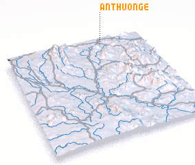 Places with similar names to An Thượng (4), Vietnam :: Disclaimer :: Information on this page comes without warranty of any kind |
||
|
Where is An Thượng (4)? Elevation and coordinates ::
Latitude (lat): 13°58'0"N Longitude (lon): 108°42'0"E
Elevation (approx.): 446m (map arrows pan, magnifying glasses zoom) |
||
|
Visiting An Thượng (4)? Hotel/Accommodation ::
Book a hotel in An Thượng (4) Travel Guide ::
Buy a travel guide for Vietnam rental cars ::
car rental offers GPS waypoint ::
download a GPX waypoint (PoI) of An Thượng (4) for your GPS receiver
|
||