|
search place name
|
||
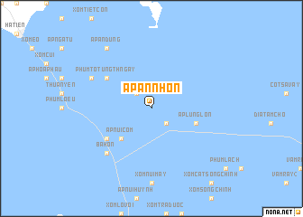
Ấp An Nhơn (Kiến Giang, Vietnam)Ấp An Nhơn is a town in the Kiến Giang region of Vietnam. An overview map of the region around Ấp An Nhơn is displayed below.
regional and 3d topo map of Ấp An Nhơn, Vietnam ::
Ấp An Nhơn airports ::
The nearest airport is PNH - Phnom-penh Phnom Penh Intl, located 139.8 km north of Ấp An Nhơn.
Nearby towns ::
Ấp An Quý (2.6km north west) //
Kiên Lương (2.6km south east) //
Ấp Núi Còm (5.2km south west) //
Ấp Lung Lớn (5.8km east) //
Phum Totưng Thngay (6.6km north west) //
Ấp Cầu Thăng (6.6km south west) //
Ba Hòn (7.8km south west) //
Ấp An Tín (8.2km north west) //
Ấp Àn Dũng (9.2km north west) //
[all distances 'as the bird flies' and approximate] 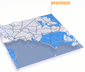 Places with similar names to Ấp An Nhơn, Vietnam ::
// Appenhain (DE)
// Ấp An Nhơn (VN)
// Ấp An Nhơn (VN)
// Ấp An Nhơn (VN)
// Ấp Nhà Nôi (VN)
// Ấp Núi Huỷnh (VN)
// Ấp Phú Nhuận (VN)
Disclaimer :: Information on this page comes without warranty of any kind |
||
|
Where is Ấp An Nhơn? Elevation and coordinates ::
Latitude (lat): 10°18'0"N Longitude (lon): 104°38'0"E
Elevation (approx.): 2m (map arrows pan, magnifying glasses zoom) |
||
|
Visiting Ấp An Nhơn? Hotel/Accommodation ::
Book a hotel in Ấp An Nhơn Travel Guide ::
Buy a travel guide for Vietnam rental cars ::
car rental offers GPS waypoint ::
download a GPX waypoint (PoI) of Ấp An Nhơn for your GPS receiver
|
||