|
search place name
|
||
Ấp Doãn Văn (Ðắc Lắk, Vietnam)Ấp Doãn Văn is a town in the Ðắc Lắk region of Vietnam. An overview map of the region around Ấp Doãn Văn is displayed below.
regional and 3d topo map of Ấp Doãn Văn, Vietnam ::

Ấp Doãn Văn airports ::
The nearest airport is SGN - Ho Chi Minh City Tansonnhat Intl, located 165.2 km south west of Ấp Doãn Văn.
Other airports nearby include NHA - Nhatrang (186.9 km east), Nearby towns ::
Bu Ya Lou (3.6km west) //
Ấp Tâm Hưng (5.2km south east) //
Bon Bu N'dron (5.6km south) //
Bu Jeng Glé (5.6km south) //
Bu Sré (5.8km north) //
Bu Daic (5.8km north) //
Bu Ðang (2) (5.7km west) //
Bon Bu Koh (5.8km north) //
Bu Row (5.8km south) //
Bu Trum (6.6km north west) //
Bu Ya (6.6km south west) //
Buôn Bu M'bré (6.6km south east) //
Bon Bu Krông Kông (6.6km south west) //
Bon Dung (1) (7.2km west) //
Bon Bu Tung (7.4km south) //
Bu N'bleing (7.5km west) //
Bu Koh (7.6km north) //
Bu Ðang (1) (8.1km north west) //
Buôn Buk So (2) (8.1km south east) //
[all distances 'as the bird flies' and approximate] 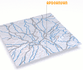 Places with similar names to Ấp Doãn Văn, Vietnam ::
// Ấp Tân Vĩnh (VN)
Disclaimer :: Information on this page comes without warranty of any kind |
||
|
Where is Ấp Doãn Văn? Elevation and coordinates ::
Latitude (lat): 12°4'0"N Longitude (lon): 107°29'0"E
Elevation (approx.): 682m (map arrows pan, magnifying glasses zoom) |
||
|
Visiting Ấp Doãn Văn? Hotel/Accommodation ::
Book a hotel in Ấp Doãn Văn Travel Guide ::
Buy a travel guide for Vietnam rental cars ::
car rental offers GPS waypoint ::
download a GPX waypoint (PoI) of Ấp Doãn Văn for your GPS receiver
|
||