|
search place name
|
||
Ấp Kha Phú Tây (Vietnam)Ấp Kha Phú Tây is a town in Vietnam. An overview map of the region around Ấp Kha Phú Tây is displayed below.
regional and 3d topo map of Ấp Kha Phú Tây, Vietnam ::

Ấp Kha Phú Tây airports ::
The nearest airport is SGN - Ho Chi Minh City Tansonnhat Intl, located 138.1 km north east of Ấp Kha Phú Tây.
Other airports nearby include PNH - Phnom-penh Phnom Penh Intl (235.5 km north west), Nearby towns ::
Ấp Phú Mỹ (0.0km north) //
Kế Sách (2.0km north west) //
Xóm Na Tung (2.6km south west) //
Xóm Phú An (2.9km south east) //
Xóm Thầy Cai (3.7km south) //
Xóm Xã Ben (4.2km west) //
Mỹ Thuận (5.5km north east) //
Ấp Mỹ Lợi (1) (5.6km north) //
Ấp Ðại An (5.6km north) //
Xóm Tập Rèn (5.9km north) //
Ấp Mỹ Thạnh (6.5km north) //
Ấp Phú Hữu (6.6km south west) //
Xóm Chùa Ông (6.6km south east) //
Xóm Tay Thong Penh (2) (7.0km west) //
An Thạnh (7.6km north) //
Xóm Xa Huon (7.5km west) //
Xóm Bà Ðốt (7.5km west) //
Xóm Bắc Chet (1) (8.0km south east) //
Ấp Hữu Thạnh (8.1km south east) //
Phú Nổ (8.3km south west) //
Phum Ô Tà Chăn (8.4km north west) //
Xóm Rạch Cui (9.2km south east) //
Ấp Phu Hòa (10.4km south east) //
Ấp Trịnh Phú (11.2km north west) //
[all distances 'as the bird flies' and approximate] 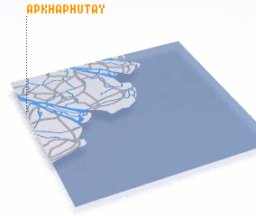 Places with similar names to Ấp Kha Phú Tây, Vietnam :: Disclaimer :: Information on this page comes without warranty of any kind |
||
|
Where is Ấp Kha Phú Tây? Elevation and coordinates ::
Latitude (lat): 9°45'0"N Longitude (lon): 106°0'0"E
Elevation (approx.): 3m (map arrows pan, magnifying glasses zoom) |
||
|
Visiting Ấp Kha Phú Tây? Hotel/Accommodation ::
Book a hotel in Ấp Kha Phú Tây Travel Guide ::
Buy a travel guide for Vietnam rental cars ::
car rental offers GPS waypoint ::
download a GPX waypoint (PoI) of Ấp Kha Phú Tây for your GPS receiver
|
||