|
search place name
|
||
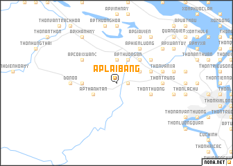
Ấp Lai Bằng (Vietnam)Ấp Lai Bằng is a town in Vietnam. An overview map of the region around Ấp Lai Bằng is displayed below.
regional and 3d topo map of Ấp Lai Bằng, Vietnam ::
Ấp Lai Bằng airports ::
The nearest airport is DAD - Danang Intl, located 96.2 km south east of Ấp Lai Bằng.
Other airports nearby include PKZ - Pakse (232.9 km south west), Nearby towns ::
Ấp Co18 Bi (1.8km east) //
Ấp Hiền Sĩ (3.7km north) //
Ấp Thanh Tân (4.0km south west) //
Ấp Thượng An (4.1km north east) //
Ấp Lai Thánh (4.1km north east) //
Ấp Phò Ninh (4.1km north east) //
Ấp Sơn Công (4.0km north east) //
Ấp Phú Lễ (5.1km north east) //
Ấp Phú Ốc (5.1km north east) //
Ấp Hiền An (5.3km west) //
Thôn Hà Lang (5.6km east) //
Thôn Thương (5.6km east) //
Ấp Hà Cảng (6.5km north east) //
Ấp Co18 Xuân (2) (6.5km north west) //
Ấp an Lỗ (6.6km north east) //
Ấp Co18 Tháp (6.6km north east) //
Ấp Hiền Lương (6.6km north east) //
Ðồn Ồ Ồ (7.1km west) //
Thôn Trung (7.1km east) //
Thôn Văn Xá (7.3km east) //
Ấp Gia Viên (8.2km north east) //
Ấp Cao Bằng (1) (8.2km north east) //
Ấp Thanh Cần (1) (9.1km north east) //
Ấp Khánh Mỹ (9.1km north west) //
Ấp Lai Xá Ha (9.0km north east) //
[all distances 'as the bird flies' and approximate] 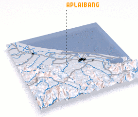 Places with similar names to Ấp Lai Bằng, Vietnam :: Disclaimer :: Information on this page comes without warranty of any kind |
||
|
Where is Ấp Lai Bằng? Elevation and coordinates ::
Latitude (lat): 16°30'0"N Longitude (lon): 107°26'0"E
Elevation (approx.): 11m (map arrows pan, magnifying glasses zoom) |
||
|
Visiting Ấp Lai Bằng? Hotel/Accommodation ::
Book a hotel in Ấp Lai Bằng Travel Guide ::
Buy a travel guide for Vietnam rental cars ::
car rental offers GPS waypoint ::
download a GPX waypoint (PoI) of Ấp Lai Bằng for your GPS receiver
|
||