|
search place name
|
||
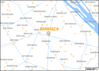
Ấp Mang Cá (Cần Thơ, Vietnam)Ấp Mang Cá is a town in the Cần Thơ region of Vietnam. An overview map of the region around Ấp Mang Cá is displayed below.
regional and 3d topo map of Ấp Mang Cá, Vietnam ::
Ấp Mang Cá airports ::
The nearest airport is SGN - Ho Chi Minh City Tansonnhat Intl, located 142.5 km north east of Ấp Mang Cá.
Other airports nearby include PNH - Phnom-penh Phnom Penh Intl (223.2 km north west), Nearby towns ::
Ấp Trinh Lợi (2) (3.4km north east) //
Ấp Trinh Tường (3.4km north east) //
Ấp Ba Rinh (3.5km south) //
Phụng Hiệp (3.8km west) //
Ấp Ðông An (2) (4.2km north) //
Ấp Mai Giầm (5.0km north west) //
Ấp Trinh Lợi (1) (5.8km north east) //
Ấp Phú Thạnh (2) (6.0km north) //
Xóm Hổ Soai (5.9km south east) //
Xóm Cà Banh (6.6km south east) //
Thuận Hòa (7.5km south) //
Ấp Hòa Lạc (7.7km north east) //
Ấp Mỹ Lợi (1) (7.8km west) //
Ấp Mỹ Húng (7.9km south west) //
Xóm Haléou (8.4km south east) //
Ấp Ðông Bình (2) (8.7km north west) //
Ấp Hòa Lợi (1) (8.7km north east) //
Ấp Trịnh Phú (8.6km east) //
Xóm Bà Ðốt (8.7km east) //
Ấp Sậy Niêu (8.9km west) //
Ấp Láng Sen (1) (10.2km north west) //
Xóm Xa Huon (10.7km south east) //
Ấp Tân Phú (1) (12.0km south west) //
[all distances 'as the bird flies' and approximate] 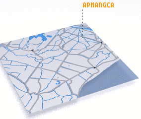 Places with similar names to Ấp Mang Cá, Vietnam :: Disclaimer :: Information on this page comes without warranty of any kind |
||
|
Where is Ấp Mang Cá? Elevation and coordinates ::
Latitude (lat): 9°47'48"N Longitude (lon): 105°51'35"E
Elevation (approx.): 2m (map arrows pan, magnifying glasses zoom) |
||
|
Visiting Ấp Mang Cá? Hotel/Accommodation ::
Book a hotel in Ấp Mang Cá Travel Guide ::
Buy a travel guide for Vietnam rental cars ::
car rental offers GPS waypoint ::
download a GPX waypoint (PoI) of Ấp Mang Cá for your GPS receiver
|
||