|
search place name
|
||
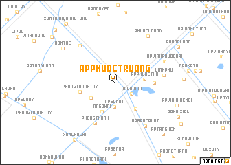
Ấp Phước Trướng (Kiến Giang, Vietnam)Ấp Phước Trướng is a town in the Kiến Giang region of Vietnam. An overview map of the region around Ấp Phước Trướng is displayed below.
regional and 3d topo map of Ấp Phước Trướng, Vietnam ::
Ấp Phước Trướng airports ::
The nearest airport is SGN - Ho Chi Minh City Tansonnhat Intl, located 211.5 km north east of Ấp Phước Trướng.
Nearby towns ::
Ấp Vĩnh An (3.2km south east) //
Ấp Số Một (4.0km south) //
Ấp Số Tám (4.7km south west) //
Ấp Phước Thọ (4.7km east) //
Ấp Số Hai (5.1km south west) //
Ấp Ranh Hạt (5.4km south east) //
Phong Thạnh Tây (5.9km west) //
Xóm Kinh Nhỏ (6.2km east) //
Phong Thạnh (7.4km south west) //
Vĩnh Phú (7.9km east) //
Xóm Thầy Cai (8.2km north west) //
Ấp Bầu Cá Một (8.5km south east) //
Ấp Vĩnh Phước Hai (8.5km north east) //
Phước Long (3) (9.2km north east) //
Xóm The (10.0km north west) //
Ấp Tăng Hem (11.4km south east) //
[all distances 'as the bird flies' and approximate]  Places with similar names to Ấp Phước Trướng, Vietnam ::
// Ấp Phước Trường (VN)
Disclaimer :: Information on this page comes without warranty of any kind |
||
|
Where is Ấp Phước Trướng? Elevation and coordinates ::
Latitude (lat): 9°23'1"N Longitude (lon): 105°22'35"E
Elevation (approx.): 2m (map arrows pan, magnifying glasses zoom) |
||
|
Visiting Ấp Phước Trướng? Hotel/Accommodation ::
Book a hotel in Ấp Phước Trướng Travel Guide ::
Buy a travel guide for Vietnam rental cars ::
car rental offers GPS waypoint ::
download a GPX waypoint (PoI) of Ấp Phước Trướng for your GPS receiver
|
||